Yazd night lights from space
Night Light of Yazd from space (Iran) Src. Average luminocity for 10x10km area is 92.8443% and for 50x50km: 20.8571%.
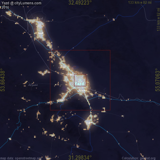
Analysis of Yazd night lights 2016
Square area 10x10 km:
 50%
50%90-99
30.04%80-89
5.86%70-79
6.23%60-69
2.2%50-59
1.65%40-49
2.56%30-39
0.73%20-29
0.73%10-19
0%0-9
0%Square area 50x50 km:
3.23%90-99
3.78%80-89
4.13%70-79
2.27%60-69
1.39%50-59
3.38%40-49
3.45%30-39
2.71%20-29
4.77%10-19
10.56%0-9
60.33%Clear (daylight) street map image can be seen on geolist.org.
Map coordinates:
32° 29' 32" North, 53° 39' 51.8" East
31° 53' 50" North, 54° 22' 3" East
31° 17' 54" North, 55° 4' 14.3" East
Some cities around Yazd sort by population:
• Ardakān
56.5 km =35.1 mi,  324°
324°
• Ābādeh
182.2 km =113.2 mi,  243°
243°
• Shahr-e Bābak
210.5 km =130.8 mi,  160°
160°
• Meybod
51.3 km =31.9 mi, 319°
• Mahrīz
35.5 km =22.1 mi,  168°
168°
• Bāfq
103.2 km =64.1 mi,  108°
108°
• Taft
23.1 km =14.4 mi,  222°
222°
• Shahrak-e Pābedānā
210.3 km =130.7 mi, 113°
111822 (p: 477,905)
Sources (retrieved 2019-11-25):
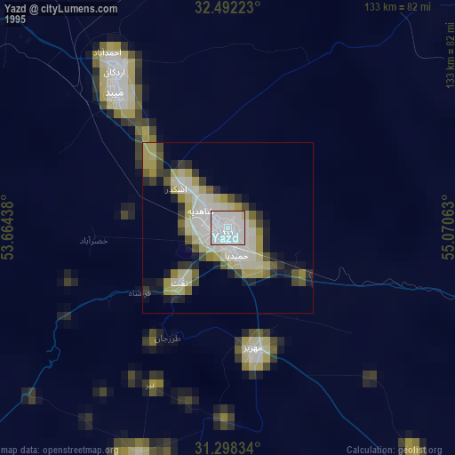
» NASA, Earths city lights 1995
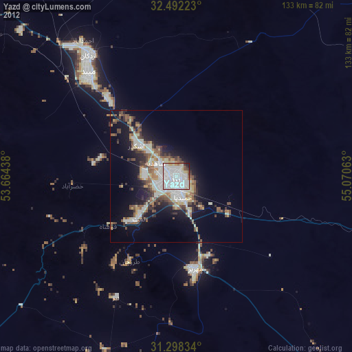
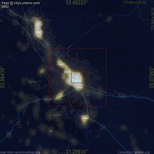
» NASA city lights 2003
» Earth at Night: Flat Maps 2012, 2016