Rasht night lights from space
Night Light of Rasht (Gīlān) from space (Iran) Src. Average luminocity for 10x10km area is 82.8469% and for 50x50km: 24.3032%.
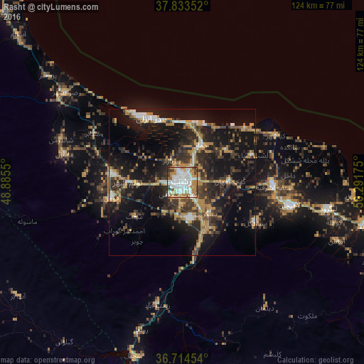
Analysis of Rasht night lights 2016
Square area 10x10 km:
 30.95%
90-99
26.53%80-89
5.44%70-79
11.05%60-69
10.03%50-59
3.57%40-49
4.25%30-39
7.48%20-29
0.68%10-19
0%0-9
0%Square area 50x50 km:
2.46%90-99
2.97%80-89
1.3%70-79
5.36%60-69
4.28%50-59
1.13%40-49
3.76%30-39
7.18%20-29
8.72%10-19
20.88%0-9
41.97%Clear (daylight) street map image can be seen on geolist.org.
Map coordinates:
37° 50' 0.7" North, 48° 53' 7.8" East
37° 16' 34" North, 49° 35' 19" East
36° 42' 52.3" North, 50° 17' 30.3" East
Some cities around Rasht sort by population:
• Bandar-e Anzalī
24.8 km =15.4 mi,  332°
332°
• Langarūd
50.7 km =31.5 mi,  100°
100°
• Khalkhāl
101 km =62.8 mi,  292°
292°
• Rūdsar
64.2 km =39.9 mi, 103°
• Hashtpar
83.5 km =51.9 mi,  313°
313°
• Āstāneh-ye Ashrafīyeh
31.4 km =19.5 mi,  92°
92°
• Fūman
25.1 km =15.6 mi,  256°
256°
• Pādegān-e Manjīl
61.4 km =38.2 mi,  194°
194°
118743 (p: 594,590)
Sources (retrieved 2019-11-25):
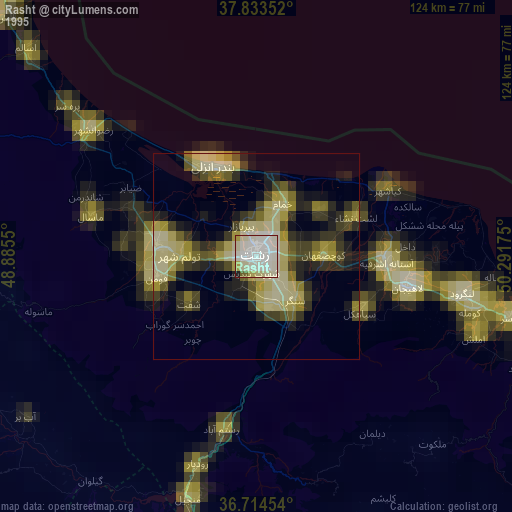
» NASA, Earths city lights 1995
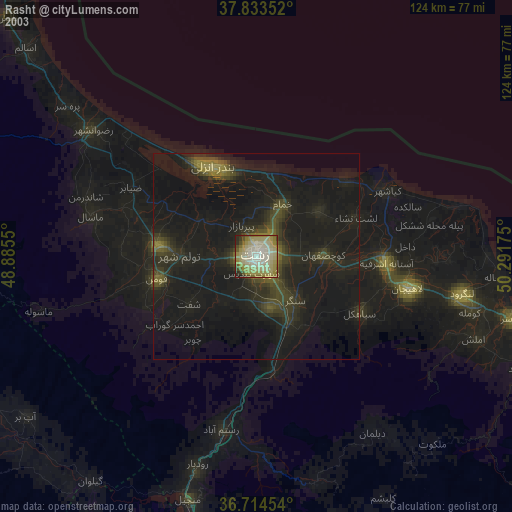
» NASA city lights 2003
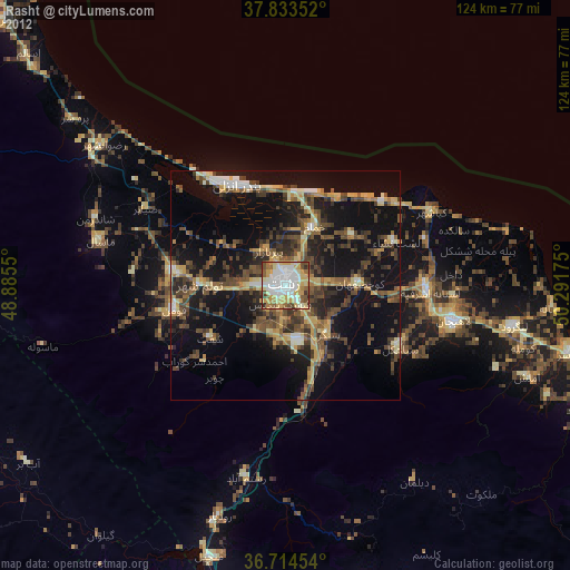
» Earth at Night: Flat Maps 2012, 2016