Langarūd night lights from space
Night Light of Langarūd (Gīlān) from space (Iran) Src. Average luminocity for 10x10km area is 35.9218% and for 50x50km: 12.2484%.
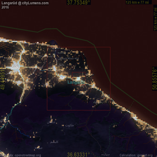
Analysis of Langarūd night lights 2016
Square area 10x10 km:
 3.57%
3.57%90-99
4.76%80-89
2.72%70-79
5.78%60-69
7.65%50-59
3.4%40-49
5.95%30-39
5.44%20-29
13.27%10-19
45.24%0-9
2.21%Square area 50x50 km:
0.56%90-99
0.83%80-89
0.55%70-79
2.08%60-69
2.74%50-59
1.13%40-49
2.87%30-39
3.03%20-29
3.92%10-19
13.94%0-9
68.33%Clear (daylight) street map image can be seen on geolist.org.
Map coordinates:
37° 45' 12.6" North, 49° 26' 58.2" East
37° 11' 43.7" North, 50° 9' 9.5" East
36° 37' 59.9" North, 50° 51' 20.7" East
Some cities around Langarūd sort by population:
• Rasht
50.7 km =31.5 mi,  280°
280°
• Bandar-e Anzalī
68.7 km =42.7 mi,  296°
296°
• Rūdsar
13.9 km =8.6 mi,  117°
117°
• Āstāneh-ye Ashrafīyeh
20 km =12.4 mi,  292°
292°
• Tonekābon
76.7 km =47.7 mi, 123°
• Fūman
74.5 km =46.3 mi,  272°
272°
• Pādegān-e Manjīl
82.6 km =51.3 mi,  232°
232°
• Nashtārūd
91.8 km =57 mi, 122°
125897 (p: 68,148)
Sources (retrieved 2019-11-25):
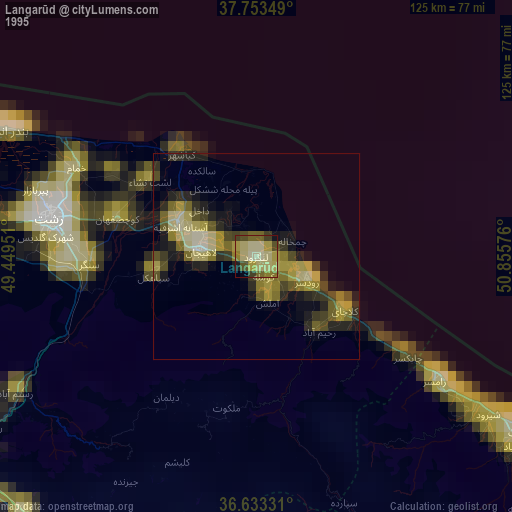
» NASA, Earths city lights 1995
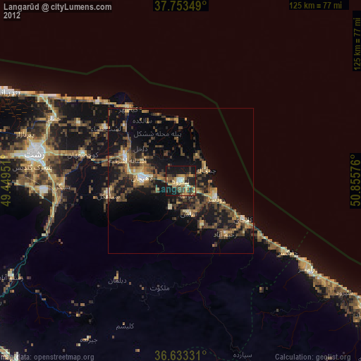
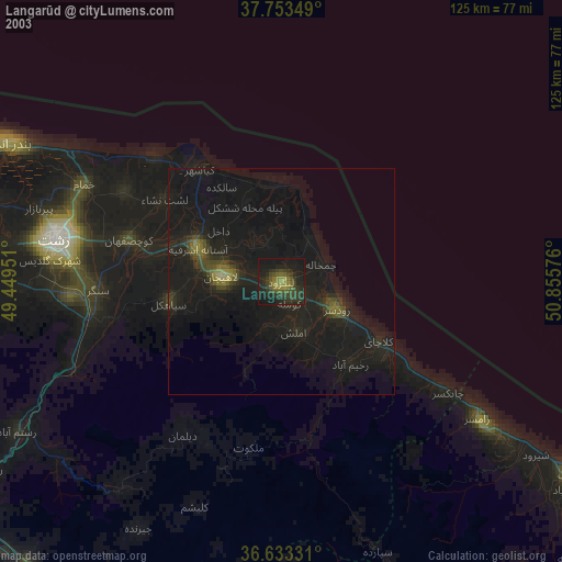
» NASA city lights 2003
» Earth at Night: Flat Maps 2012, 2016