Nashtārūd night lights from space
Night Light of Nashtārūd (Māzandarān) from space (Iran) Src. Average luminocity for 10x10km area is 28.7675% and for 50x50km: 9.1327%.
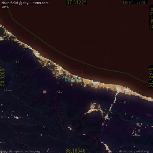
Analysis of Nashtārūd night lights 2016
Square area 10x10 km:
 0%
0%90-99
0.17%80-89
1.22%70-79
5.94%60-69
10.31%50-59
4.2%40-49
8.92%30-39
7.17%20-29
9.79%10-19
29.37%0-9
22.9%Square area 50x50 km:
0.17%90-99
0.35%80-89
0.17%70-79
2.99%60-69
2.24%50-59
1.07%40-49
1.67%30-39
1.84%20-29
2.75%10-19
10.16%0-9
76.59%Clear (daylight) street map image can be seen on geolist.org.
Map coordinates:
37° 18' 43.9" North, 50° 19' 13.8" East
36° 45' 3.2" North, 51° 1' 25" East
36° 11' 7.7" North, 51° 43' 36.3" East
Some cities around Nashtārūd sort by population:
• Karaj
102.1 km =63.4 mi,  181°
181°
• Naz̧arābād
96.2 km =59.8 mi,  202°
202°
• Chālūs
36.9 km =22.9 mi,  106°
106°
• Langarūd
91.8 km =57 mi,  302°
302°
• Ābyek
87.1 km =54.1 mi,  209°
209°
• Rūdsar
77.9 km =48.4 mi, 303°
• Nowshahr
43.6 km =27.1 mi, 105°
• Tonekābon
15.2 km =9.4 mi, 298°
122560 (p: 5,837)
Sources (retrieved 2019-11-25):
» Earth at Night: Flat Maps 2012, 2016