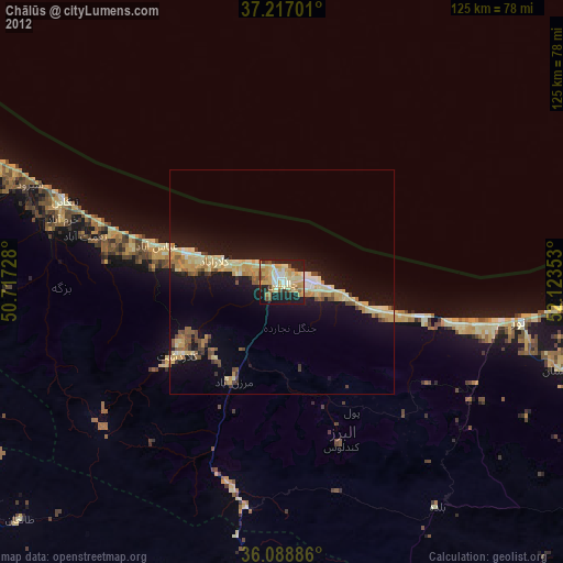
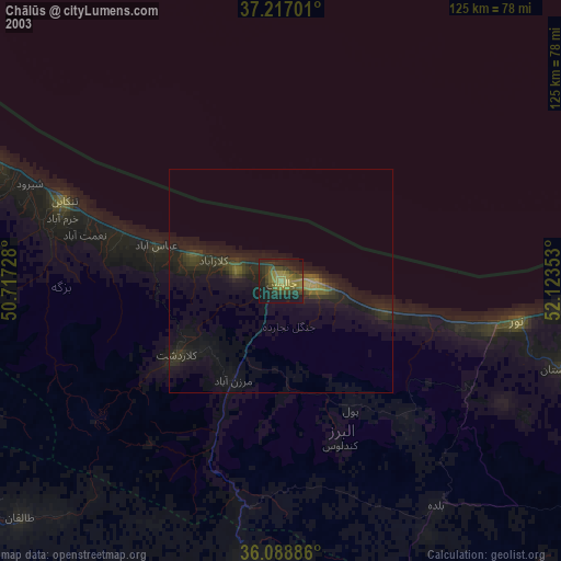
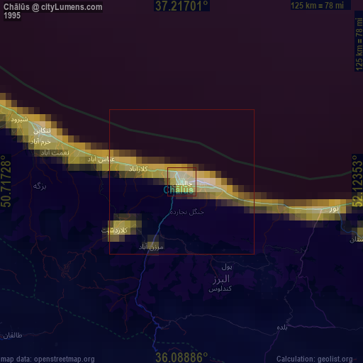
Chālūs night lights from space
Night Light of Chālūs (Māzandarān) from space (Iran) Src. Average luminocity for 10x10km area is 53.022% and for 50x50km: 10.9975%.
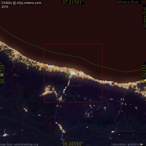
Analysis of Chālūs night lights 2016
Square area 10x10 km:
 3.48%
3.48%90-99
8.61%80-89
2.56%70-79
23.26%60-69
14.84%50-59
2.2%40-49
4.21%30-39
6.59%20-29
21.98%10-19
12.27%0-9
0%Square area 50x50 km:
0.49%90-99
1.12%80-89
0.49%70-79
3.89%60-69
2.43%50-59
0.91%40-49
1.25%30-39
1.01%20-29
2.96%10-19
10.98%0-9
74.46%Clear (daylight) street map image can be seen on geolist.org.
Map coordinates:
37° 13' 1.2" North, 50° 43' 2.2" East
36° 39' 18" North, 51° 25' 13.4" East
36° 5' 19.9" North, 52° 7' 24.7" East
Some cities around Chālūs sort by population:
• Tehran
106.8 km =66.4 mi,  179°
179°
• Karaj
99.2 km =61.6 mi,  202°
202°
• Āmol
85.6 km =53.2 mi,  103°
103°
• Ābyek
101.8 km =63.3 mi,  229°
229°
• Nowshahr
6.8 km =4.2 mi, 96°
• Tonekābon
51.9 km =32.2 mi,  290°
290°
• Fereydūnkenār
98.4 km =61.1 mi,  87°
87°
• Nashtārūd
36.9 km =22.9 mi, 286°
139223 (p: 69,638)
Sources (retrieved 2019-11-25):
» NASA, Earths city lights 1995
» NASA city lights 2003
» Earth at Night: Flat Maps 2012, 2016