Marvdasht night lights from space
Night Light of Marvdasht (Fars) from space (Iran) Src. Average luminocity for 10x10km area is 60.9742% and for 50x50km: 17.1489%.
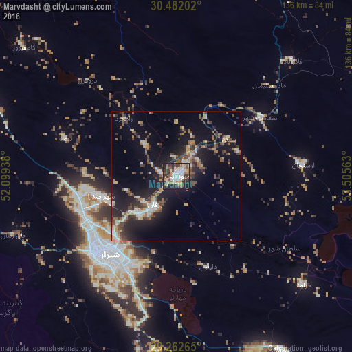
Analysis of Marvdasht night lights 2016
Square area 10x10 km:
 15.28%
90-99
16.27%80-89
3.57%70-79
3.37%60-69
11.51%50-59
7.14%40-49
7.14%30-39
13.89%20-29
18.45%10-19
3.37%0-9
0%Square area 50x50 km:
1.65%90-99
3%80-89
1.17%70-79
1.52%60-69
2.57%50-59
2.98%40-49
2.89%30-39
3.01%20-29
6.07%10-19
13.46%0-9
61.7%Clear (daylight) street map image can be seen on geolist.org.
Map coordinates:
30° 28' 55.3" North, 52° 5' 57.8" East
29° 52' 27.1" North, 52° 48' 9" East
29° 15' 45.5" North, 53° 30' 20.3" East
Some cities around Marvdasht sort by population:
• Shiraz
39.3 km =24.4 mi,  221°
221°
• Akbarābād
69.8 km =43.4 mi,  181°
181°
• Fasā
132.4 km =82.3 mi,  141°
141°
• Kāzerūn
114.5 km =71.1 mi,  255°
255°
• Fīrūzābād
116.8 km =72.6 mi,  191°
191°
• Nūrābād
126.2 km =78.4 mi,  282°
282°
• Ābādeh
143.8 km =89.4 mi,  354°
354°
• Pāsārgād
51.5 km =32 mi,  44°
44°
124721 (p: 148,858)
Sources (retrieved 2019-11-25):
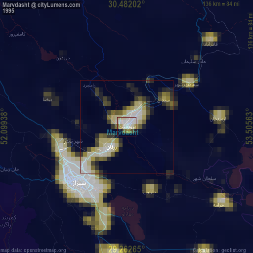
» NASA, Earths city lights 1995
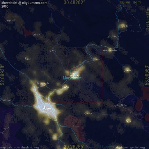
» NASA city lights 2003
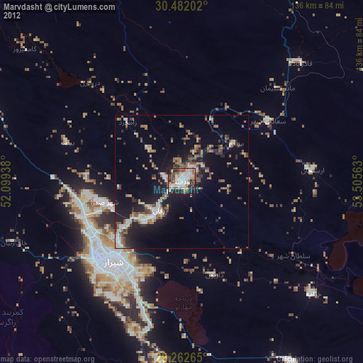
» Earth at Night: Flat Maps 2012, 2016