Javānrūd night lights from space
Night Light of Javānrūd (Kermānshāh) from space (Iran) Src. Average luminocity for 10x10km area is 14.3205% and for 50x50km: 2.051%.
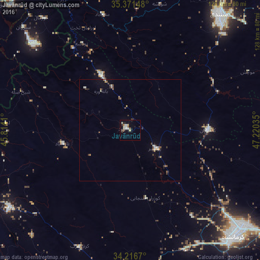
Analysis of Javānrūd night lights 2016
Square area 10x10 km:
 2.38%
2.38%90-99
4.4%80-89
0.73%70-79
1.28%60-69
1.47%50-59
1.47%40-49
0.18%30-39
1.83%20-29
2.2%10-19
3.3%0-9
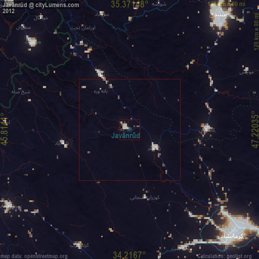
80.77%Square area 50x50 km:
0.13%90-99
0.43%80-89
0.11%70-79
0.2%60-69
0.26%50-59
0.3%40-49
0.23%30-39
0.41%20-29
0.47%10-19
0.62%0-9
96.84%Clear (daylight) street map image can be seen on geolist.org.
Map coordinates:
35° 22' 17.3" North, 45° 48' 50.8" East
34° 47' 46" North, 46° 31' 2" East
34° 13' 0.1" North, 47° 13' 13.3" East
Some cities around Javānrūd sort by population:
• Kahrīz
67.3 km =41.8 mi,  132°
132°
• Kermanshah
73.4 km =45.6 mi,  136°
136°
• Sanandaj
72.5 km =45 mi,  37°
37°
• Marīvān
85.9 km =53.4 mi,  339°
339°
• Kāmyārān
38.2 km =23.7 mi,  90°
90°
• Ḩalabjah, IQ
64.4 km =40 mi,  311°
311°
• Sarpol-e Z̄ahāb
70.5 km =43.8 mi,  238°
238°
• Pāveh
31.2 km =19.4 mi,  331°
331°
130245 (p: 38,657)
Sources (retrieved 2019-11-25):
» Earth at Night: Flat Maps 2012, 2016