Asadābād night lights from space
Night Light of Asadābād (Hamadān) from space (Iran) Src. Average luminocity for 10x10km area is 29.4286% and for 50x50km: 3.7555%.
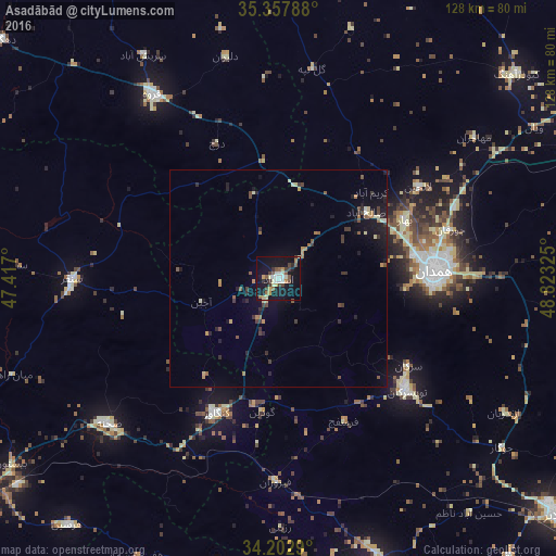
Analysis of Asadābād night lights 2016
Square area 10x10 km:
 4.03%
4.03%90-99
4.4%80-89
4.21%70-79
2.56%60-69
3.11%50-59
4.76%40-49
4.58%30-39
5.86%20-29
1.28%10-19
38.28%0-9
26.92%Square area 50x50 km:
0.19%90-99
0.31%80-89
0.53%70-79
0.33%60-69
0.55%50-59
0.61%40-49
0.56%30-39
0.91%20-29
0.69%10-19
3.44%0-9
91.88%Clear (daylight) street map image can be seen on geolist.org.
Map coordinates:
35° 21' 28.4" North, 47° 25' 1.2" East
34° 46' 56.7" North, 48° 7' 12.4" East
34° 12' 10.4" North, 48° 49' 23.7" East
Some cities around Asadābād sort by population:
• Pasragad Branch
32.1 km =19.9 mi,  90°
90°
• Hamadān
36.1 km =22.4 mi, 87°
• Āzādshahr
41.1 km =25.5 mi, 88°
• Qorveh
51.4 km =31.9 mi,  326°
326°
• Nahāvand
69.8 km =43.4 mi,  160°
160°
• Kangāvar
34 km =21.1 mi,  204°
204°
• Sonqor
47.5 km =29.5 mi,  269°
269°
• Bahār
32.4 km =20.1 mi,  64°
64°
142872 (p: 59,617)
Sources (retrieved 2019-11-25):
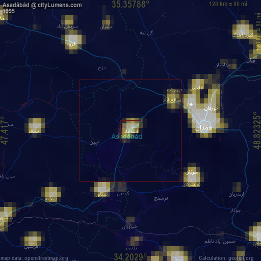
» NASA, Earths city lights 1995
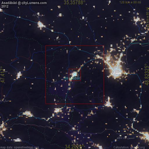
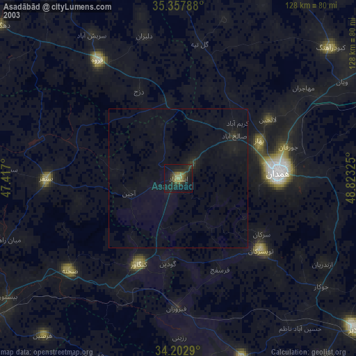
» NASA city lights 2003
» Earth at Night: Flat Maps 2012, 2016