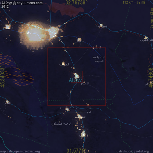
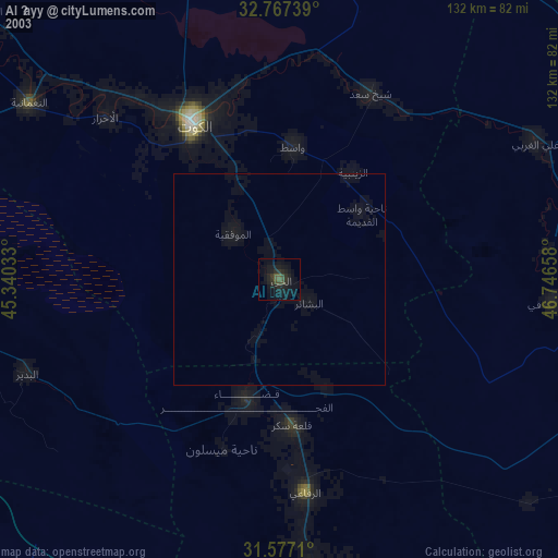
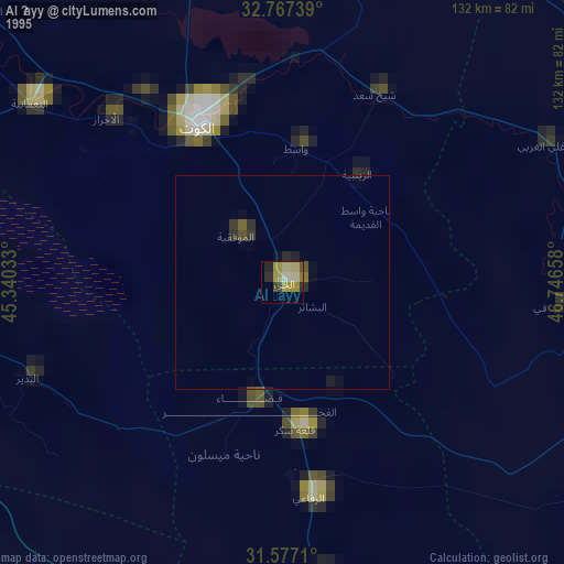
Al Ḩayy night lights from space
Night Light of Al Ḩayy (Wāsiţ) from space (Iraq) Src. Average luminocity for 10x10km area is 32.8269% and for 50x50km: 3.1007%.
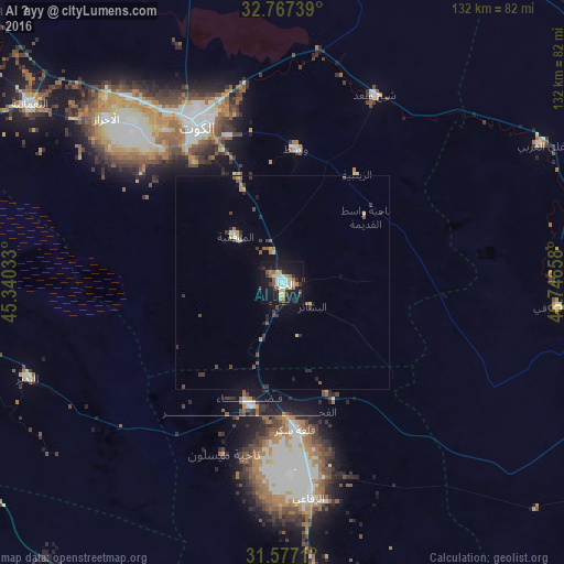
Analysis of Al Ḩayy night lights 2016
Square area 10x10 km:
 4.37%
4.37%90-99
6.12%80-89
4.2%70-79
2.27%60-69
5.59%50-59
4.37%40-49
2.45%30-39
4.55%20-29
6.99%10-19
43.18%0-9
15.91%Square area 50x50 km:
0.18%90-99
0.39%80-89
0.3%70-79
0.29%60-69
0.4%50-59
0.43%40-49
0.59%30-39
0.74%20-29
0.67%10-19
2.39%0-9
93.62%Clear (daylight) street map image can be seen on geolist.org.
Map coordinates:
32° 46' 2.6" North, 45° 20' 25.2" East
32° 10' 27.1" North, 46° 2' 36.4" East
31° 34' 37.6" North, 46° 44' 47.7" East
Some cities around Al Ḩayy sort by population:
• Al ‘Amārah
110.5 km =68.7 mi,  109°
109°
• Ad Dīwānīyah
107.2 km =66.6 mi,  259°
259°
• Al Kūt
43.2 km =26.8 mi,  330°
330°
• Ash Shaţrah
85.9 km =53.4 mi,  171°
171°
• Ar Rumaythah
107 km =66.5 mi,  227°
227°
• ‘Afak
76 km =47.2 mi, 260°
• ‘Alī al Gharbī
68.5 km =42.6 mi,  62°
62°
• Mehrān, IR
106 km =65.9 mi,  6°
6°
99350 (p: 78,272)
Sources (retrieved 2019-11-25):
» NASA, Earths city lights 1995
» NASA city lights 2003
» Earth at Night: Flat Maps 2012, 2016