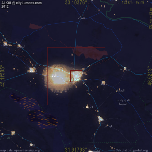
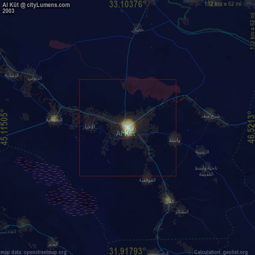
Al Kūt night lights from space
Night Light of Al Kūt (Wāsiţ) from space (Iraq) Src. Average luminocity for 10x10km area is 87.1612% and for 50x50km: 19.5684%.
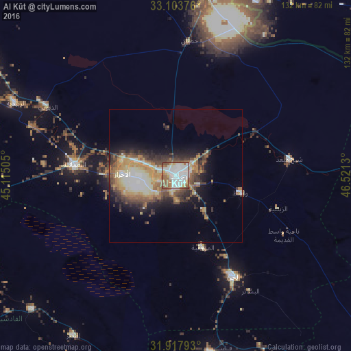

Analysis of Al Kūt night lights 2016
Square area 10x10 km:
 37.91%
90-99
26.37%80-89
5.31%70-79
6.23%60-69
13.55%50-59
8.24%40-49
2.38%30-39
0%20-29
0%10-19
0%0-9
0%Square area 50x50 km:
2.54%90-99
4.5%80-89
2.44%70-79
2.94%60-69
3.06%50-59
2.98%40-49
2.97%30-39
3.38%20-29
3.53%10-19
6.23%0-9
65.42%Clear (daylight) street map image can be seen on geolist.org.
Map coordinates:
33° 6' 13.5" North, 45° 6' 54.2" East
32° 30' 46.1" North, 45° 49' 5.4" East
31° 55' 4.5" North, 46° 31' 16.7" East
Some cities around Al Kūt sort by population:
• Ad Dīwānīyah
101.9 km =63.3 mi,  235°
235°
• Al Ḩayy
43.2 km =26.8 mi,  150°
150°
• Al ‘Azīzīyah
83.2 km =51.7 mi,  301°
301°
• Aş Şuwayrah
107.8 km =67 mi, 295°
• Imam Qasim
109.2 km =67.9 mi,  257°
257°
• ‘Afak
73.2 km =45.5 mi,  227°
227°
• ‘Alī al Gharbī
81.8 km =50.8 mi,  93°
93°
• Mehrān, IR
75.1 km =46.7 mi,  25°
25°
99131 (p: 315,162)
Sources (retrieved 2019-11-25):
» NASA, Earths city lights 1995
» NASA city lights 2003
» Earth at Night: Flat Maps 2012, 2016