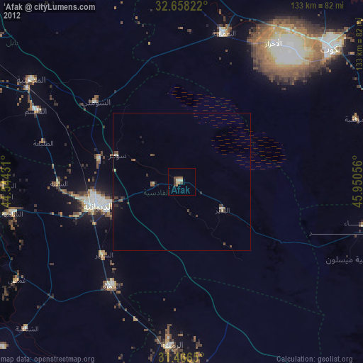
‘Afak night lights from space
Night Light of ‘Afak (Al Qādisīyah) from space (Iraq) Src. Average luminocity for 10x10km area is 12.8129% and for 50x50km: 2.8638%.
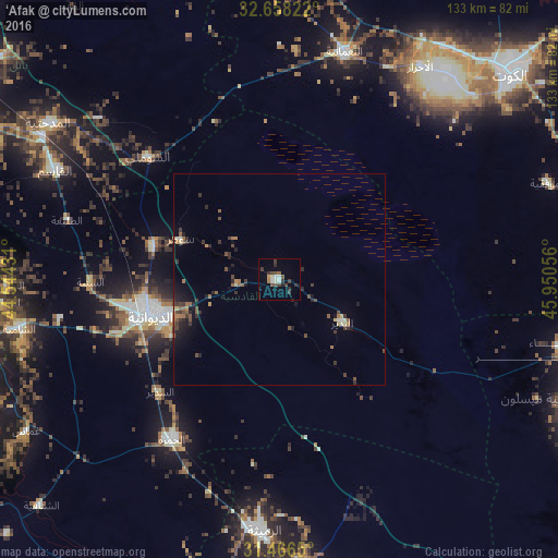
Analysis of ‘Afak night lights 2016
Square area 10x10 km:
 1.57%
1.57%90-99
1.92%80-89
0.7%70-79
0.7%60-69
0.87%50-59
1.05%40-49
4.37%30-39
3.85%20-29
2.8%10-19
1.57%0-9
80.59%Square area 50x50 km:
0.08%90-99
0.24%80-89
0.2%70-79
0.23%60-69
0.45%50-59
0.55%40-49
0.72%30-39
0.86%20-29
0.95%10-19
1.35%0-9
94.39%Clear (daylight) street map image can be seen on geolist.org.
Map coordinates:
32° 39' 29.6" North, 44° 32' 39.5" East
32° 3' 51.5" North, 45° 14' 50.7" East
31° 27' 59.4" North, 45° 57' 2" East
Some cities around ‘Afak sort by population:
• Ad Dīwānīyah
31.4 km =19.5 mi,  255°
255°
• Al Kūt
73.2 km =45.5 mi,  47°
47°
• Kufa
76.1 km =47.3 mi,  268°
268°
• Al Ḩayy
76 km =47.2 mi,  80°
80°
• Ash Shāmīyah
62 km =38.5 mi, 259°
• Ar Rumaythah
59.7 km =37.1 mi,  183°
183°
• Imam Qasim
59.1 km =36.7 mi,  296°
296°
• Nahiyat Ghammas
69.2 km =43 mi,  238°
238°
99738 (p: 21,888)
Sources (retrieved 2019-11-25):
» Earth at Night: Flat Maps 2012, 2016