Tānda night lights from space
Night Light of Tānda (Uttar Pradesh) from space (India) Src. Average luminocity for 10x10km area is 24.7163% and for 50x50km: 30.2869%.
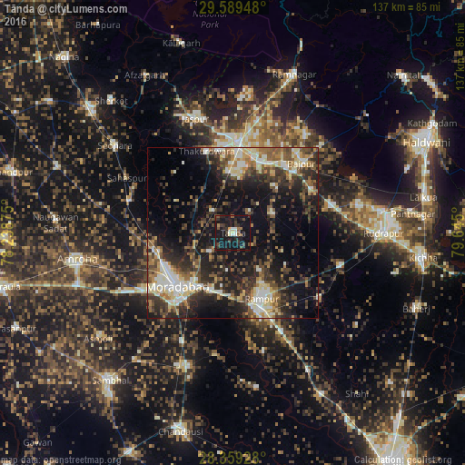
Analysis of Tānda night lights 2016
Square area 10x10 km:
 1.98%
1.98%90-99
2.78%80-89
1.59%70-79
0.99%60-69
2.18%50-59
2.98%40-49
5.56%30-39
8.93%20-29
7.74%10-19
54.37%0-9
10.91%Square area 50x50 km:
3%90-99
5.22%80-89
4.21%70-79
2.4%60-69
3.69%50-59
5.21%40-49
6.22%30-39
7.24%20-29
10.6%10-19
18.15%0-9
34.08%Clear (daylight) street map image can be seen on geolist.org.
Map coordinates:
29° 35' 22.1" North, 78° 14' 19.5" East
28° 58' 34.4" North, 78° 56' 30.7" East
28° 21' 33.4" North, 79° 38' 42" East
Some cities around Tānda sort by population:
• Morādābād
22.2 km =13.8 mi,  226°
226°
• Rāmpur
20.2 km =12.6 mi,  155°
155°
• Kashipur
26.5 km =16.5 mi,  3°
3°
• Thakurdwara
25.2 km =15.7 mi,  341°
341°
• Suār
12.6 km =7.8 mi,  62°
62°
• Kemrī
31.8 km =19.8 mi,  126°
126°
• Kānth
31.7 km =19.7 mi,  286°
286°
• Bāzpur
25.4 km =15.8 mi,  39°
39°
1255023 (p: 44,822)
Sources (retrieved 2019-11-25):
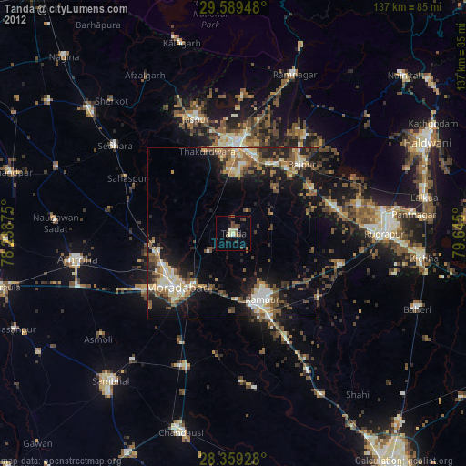
» Earth at Night: Flat Maps 2012, 2016