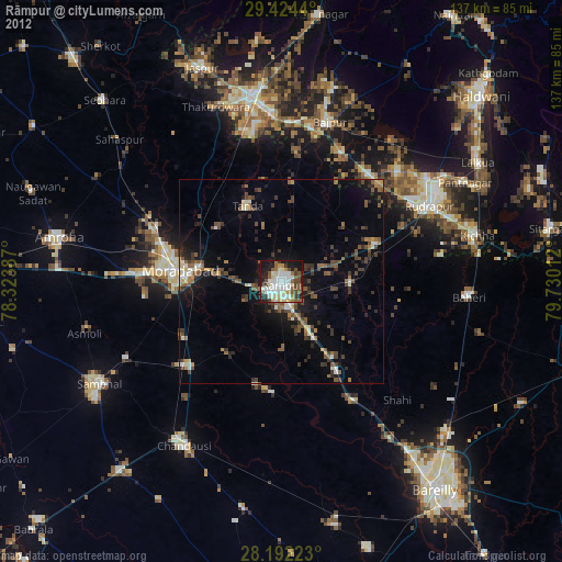
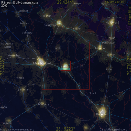
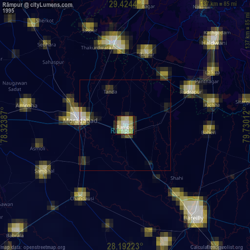
Rāmpur night lights from space
Night Light of Rāmpur (Uttar Pradesh) from space (India) Src. Average luminocity for 10x10km area is 70.8258% and for 50x50km: 22.448%.
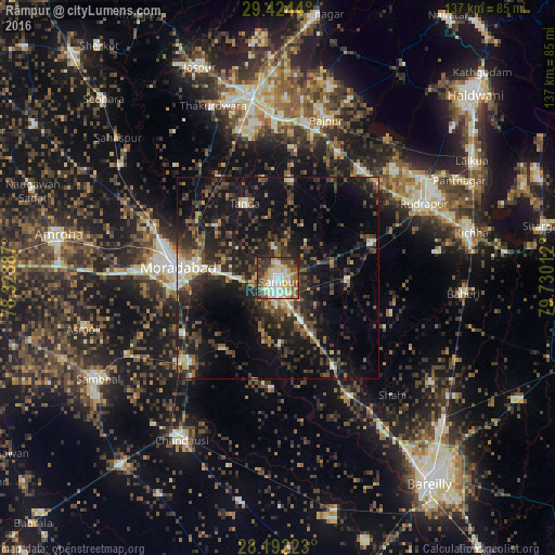
Analysis of Rāmpur night lights 2016
Square area 10x10 km:
 14.96%
90-99
17.23%80-89
19.32%70-79
4.17%60-69
8.14%50-59
9.09%40-49
10.04%30-39
8.71%20-29
8.14%10-19
0.19%0-9
0%Square area 50x50 km:
1.67%90-99
2.61%80-89
2.46%70-79
1.4%60-69
2.32%50-59
3.86%40-49
5.73%30-39
6.37%20-29
10.11%10-19
18.97%0-9
44.5%Clear (daylight) street map image can be seen on geolist.org.
Map coordinates:
29° 25' 27.8" North, 78° 19' 25.9" East
28° 48' 36.5" North, 79° 1' 37.2" East
28° 11' 32" North, 79° 43' 48.4" East
Some cities around Rāmpur sort by population:
• Morādābād
24.6 km =15.3 mi,  277°
277°
• Tānda
20.2 km =12.6 mi,  335°
335°
• Bīlāspur
25.2 km =15.7 mi,  70°
70°
• Shāhābād
27.1 km =16.8 mi,  183°
183°
• Suār
24.4 km =15.2 mi,  6°
6°
• Milak
26.2 km =16.3 mi,  147°
147°
• Kundarkhi
27.5 km =17.1 mi,  239°
239°
• Kemrī
17.3 km =10.7 mi,  91°
91°
1258599 (p: 296,418)
Sources (retrieved 2019-11-25):
» NASA, Earths city lights 1995
» NASA city lights 2003
» Earth at Night: Flat Maps 2012, 2016