Suār night lights from space
Night Light of Suār (Uttar Pradesh) from space (India) Src. Average luminocity for 10x10km area is 17.0794% and for 50x50km: 30.1079%.
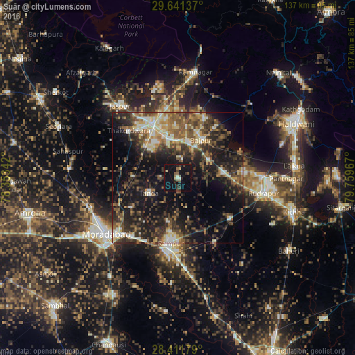
Analysis of Suār night lights 2016
Square area 10x10 km:
 0%
0%90-99
2.38%80-89
1.98%70-79
0.4%60-69
0.2%50-59
5.75%40-49
1.79%30-39
4.56%20-29
4.56%10-19
16.47%0-9
61.9%Square area 50x50 km:
2.37%90-99
4.18%80-89
4.21%70-79
2.72%60-69
3.84%50-59
6.07%40-49
6.93%30-39
7.47%20-29
11.09%10-19
18.68%0-9
32.45%Clear (daylight) street map image can be seen on geolist.org.
Map coordinates:
29° 38' 28.9" North, 78° 21' 12.3" East
29° 1' 42.3" North, 79° 3' 23.5" East
28° 24' 42.4" North, 79° 45' 34.8" East
Some cities around Suār sort by population:
• Morādābād
34.4 km =21.4 mi,  232°
232°
• Rāmpur
24.4 km =15.2 mi,  186°
186°
• Kashipur
22.8 km =14.2 mi,  334°
334°
• Tānda
12.6 km =7.8 mi,  242°
242°
• Bīlāspur
26.1 km =16.2 mi,  127°
127°
• Thakurdwara
26.3 km =16.3 mi,  313°
313°
• Kemrī
28.6 km =17.8 mi,  149°
149°
• Bāzpur
14.7 km =9.1 mi,  19°
19°
1255597 (p: 28,941)
Sources (retrieved 2019-11-25):
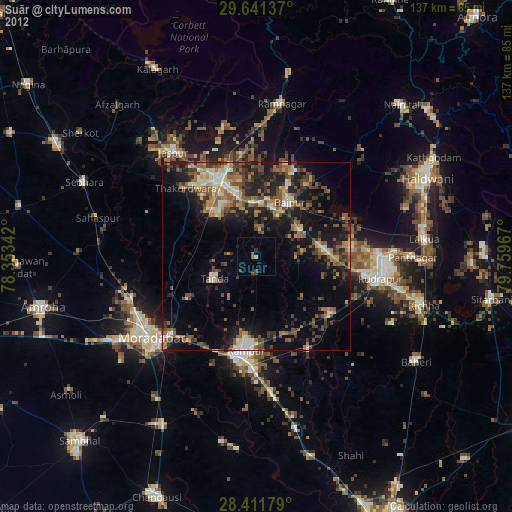
» Earth at Night: Flat Maps 2012, 2016