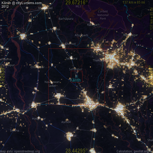
Kānth night lights from space
Night Light of Kānth (Uttar Pradesh) from space (India) Src. Average luminocity for 10x10km area is 17.5337% and for 50x50km: 24.1626%.
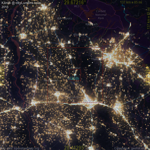
Analysis of Kānth night lights 2016
Square area 10x10 km:
 0.6%
0.6%90-99
1.39%80-89
1.19%70-79
2.18%60-69
1.19%50-59
2.98%40-49
7.54%30-39
1.79%20-29
0.99%10-19
16.87%0-9
63.29%Square area 50x50 km:
1.1%90-99
2.61%80-89
1.57%70-79
2.04%60-69
3.22%50-59
4.67%40-49
7.49%30-39
7.87%20-29
10.35%10-19
22.89%0-9
36.19%Clear (daylight) street map image can be seen on geolist.org.
Map coordinates:
29° 40' 19.8" North, 77° 55' 35" East
29° 3' 33.8" North, 78° 37' 46.2" East
28° 26' 34.6" North, 79° 19' 57.5" East
Some cities around Kānth sort by population:
• Morādābād
28.4 km =17.6 mi,  149°
149°
• Amroha
23.3 km =14.5 mi,  221°
221°
• Dhāmpur
30 km =18.6 mi,  337°
337°
• Seohāra
17.1 km =10.6 mi,  346°
346°
• Thakurdwara
26.9 km =16.7 mi,  56°
56°
• Nūrpur
23.7 km =14.7 mi,  295°
295°
• Sahaspur
6.9 km =4.3 mi, 354°
• Tājpur
18.2 km =11.3 mi,  309°
309°
1267972 (p: 24,883)
Sources (retrieved 2019-11-25):
» Earth at Night: Flat Maps 2012, 2016