Kashipur night lights from space
Night Light of Kashipur (Uttarakhand) from space (India) Src. Average luminocity for 10x10km area is 81.3651% and for 50x50km: 27.053%.
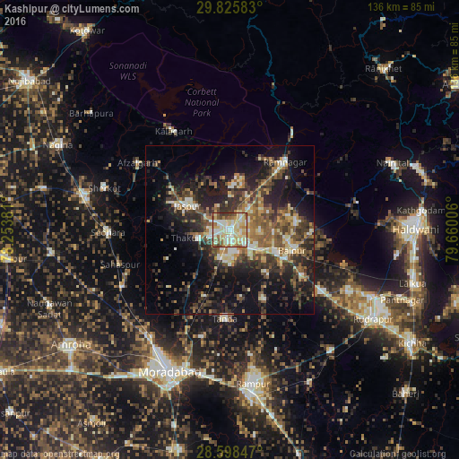
Analysis of Kashipur night lights 2016
Square area 10x10 km:
 14.29%
90-99
24.6%80-89
28.37%70-79
9.52%60-69
8.73%50-59
7.34%40-49
4.17%30-39
2.98%20-29
0%10-19
0%0-9
0%Square area 50x50 km:
1.98%90-99
3.97%80-89
3.89%70-79
3.03%60-69
3.78%50-59
5.43%40-49
5.52%30-39
6.59%20-29
8.66%10-19
15.88%0-9
41.28%Clear (daylight) street map image can be seen on geolist.org.
Map coordinates:
29° 49' 33" North, 78° 15' 13.7" East
29° 12' 50.4" North, 78° 57' 24.9" East
28° 35' 54.5" North, 79° 39' 36.2" East
Some cities around Kashipur sort by population:
• Rāmnagar
25.9 km =16.1 mi,  39°
39°
• Tānda
26.5 km =16.5 mi,  183°
183°
• Jaspur
14.5 km =9 mi,  300°
300°
• Thakurdwara
9.6 km =6 mi,  255°
255°
• Suār
22.8 km =14.2 mi,  154°
154°
• Afzalgarh
33.9 km =21.1 mi,  306°
306°
• Bāzpur
16.2 km =10.1 mi,  114°
114°
• Kālāgarh Project Colony
33.8 km =21 mi,  330°
330°
1267579 (p: 103,138)
Sources (retrieved 2019-11-25):
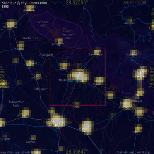
» NASA, Earths city lights 1995
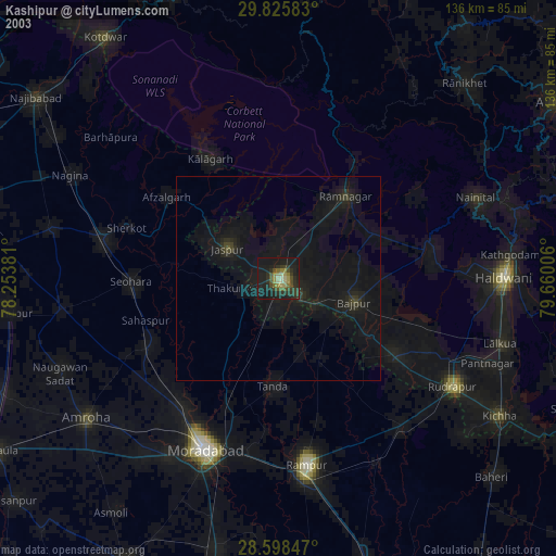
» NASA city lights 2003
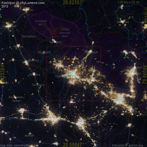
» Earth at Night: Flat Maps 2012, 2016