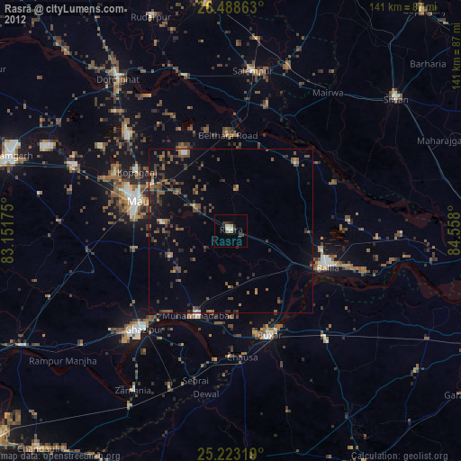
Rasrā night lights from space
Night Light of Rasrā (Uttar Pradesh) from space (India) Src. Average luminocity for 10x10km area is 35.839% and for 50x50km: 33.5258%.

Analysis of Rasrā night lights 2016
Square area 10x10 km:
 2.84%
2.84%90-99
3.98%80-89
0%70-79
3.41%60-69
4.92%50-59
6.82%40-49
12.88%30-39
13.45%20-29
19.7%10-19
31.82%0-9
0.19%Square area 50x50 km:
0.99%90-99
1.92%80-89
2.22%70-79
3.67%60-69
5.58%50-59
8.2%40-49
10.79%30-39
13.25%20-29
16.62%10-19
30.59%0-9
6.17%Clear (daylight) street map image can be seen on geolist.org.
Map coordinates:
26° 29' 19.1" North, 83° 9' 6.3" East
25° 51' 27.4" North, 83° 51' 17.5" East
25° 13' 23.5" North, 84° 33' 28.8" East
Some cities around Rasrā sort by population:
• Mau
30.8 km =19.1 mi,  287°
287°
• Buxar
33.8 km =21 mi,  158°
158°
• Kopāganj
34 km =21.1 mi,  301°
301°
• Muhammadābād
28.3 km =17.6 mi,  200°
200°
• Sikandarpur
28.6 km =17.8 mi,  43°
43°
• Bānsdīh
36.5 km =22.7 mi,  85°
85°
• Maniar
34.8 km =21.6 mi,  65°
65°
• Bilthra
30.2 km =18.8 mi,  6°
6°
1258380 (p: 31,876)
Sources (retrieved 2019-11-25):
» Earth at Night: Flat Maps 2012, 2016