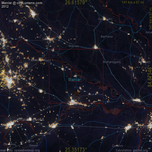
Maniar night lights from space
Night Light of Maniar (Uttar Pradesh) from space (India) Src. Average luminocity for 10x10km area is 21.6508% and for 50x50km: 19.0446%.
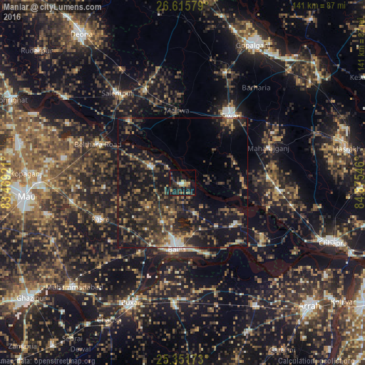
Analysis of Maniar night lights 2016
Square area 10x10 km:
 1.19%
1.19%90-99
0.4%80-89
2.18%70-79
4.17%60-69
2.78%50-59
1.59%40-49
3.77%30-39
8.53%20-29
9.92%10-19
24.6%0-9
40.87%Square area 50x50 km:
0.8%90-99
1.11%80-89
1.25%70-79
2.1%60-69
2.51%50-59
3.4%40-49
5.26%30-39
6.74%20-29
9.51%10-19
21.61%0-9
45.71%Clear (daylight) street map image can be seen on geolist.org.
Map coordinates:
26° 36' 56.8" North, 83° 28' 9.2" East
25° 59' 7.7" North, 84° 10' 20.4" East
25° 21' 6.2" North, 84° 52' 31.7" East
Some cities around Maniar sort by population:
• Siwān
32 km =19.9 mi,  35°
35°
• Rasrā
34.8 km =21.6 mi,  245°
245°
• Lar
31.7 km =19.7 mi,  320°
320°
• Sikandarpur
13.5 km =8.4 mi,  298°
298°
• Reoti
25.4 km =15.8 mi,  126°
126°
• Bānsdīh
12.2 km =7.6 mi,  157°
157°
• Mairwa
27.4 km =17 mi,  358°
358°
• Bilthra
32.2 km =20 mi, 299°
1263730 (p: 20,462)
Sources (retrieved 2019-11-25):
» Earth at Night: Flat Maps 2012, 2016