Kopāganj night lights from space
Night Light of Kopāganj (Uttar Pradesh) from space (India) Src. Average luminocity for 10x10km area is 69.5913% and for 50x50km: 47.0911%.

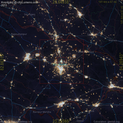
Analysis of Kopāganj night lights 2016
Square area 10x10 km:
 7.74%
7.74%90-99
8.93%80-89
12.1%70-79
16.07%60-69
20.24%50-59
23.61%40-49
11.11%30-39
0.2%20-29
0%10-19
0%0-9
0%Square area 50x50 km:
3.46%90-99
4.59%80-89
4.46%70-79
6.59%60-69
10.3%50-59
13.72%40-49
14.2%30-39
12.68%20-29
16.09%10-19
11.25%0-9
2.67%Clear (daylight) street map image can be seen on geolist.org.
Map coordinates:
26° 38' 57.8" North, 82° 51' 47.4" East
26° 1' 9.2" North, 83° 33' 58.7" East
25° 23' 8.4" North, 84° 16' 9.9" East
Some cities around Kopāganj sort by population:
• Mau
8.6 km =5.3 mi,  183°
183°
• Mubārakpur
28.6 km =17.8 mi,  285°
285°
• Ghosī
10 km =6.2 mi,  344°
344°
• Rasrā
34 km =21.1 mi,  121°
121°
• Muhammadābād
18.6 km =11.6 mi,  275°
275°
• Chillupār
29.8 km =18.5 mi,  348°
348°
• Jainpur
27.5 km =17.1 mi,  302°
302°
• Dohrighāt
28.7 km =17.8 mi, 348°
1266164 (p: 33,539)
Sources (retrieved 2019-11-25):
» Earth at Night: Flat Maps 2012, 2016