Pudukkottai night lights from space
Night Light of Pudukkottai (Tamil Nadu) from space (India) Src. Average luminocity for 10x10km area is 31.3636% and for 50x50km: 2.8567%.
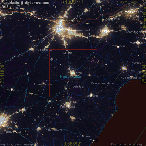
Analysis of Pudukkottai night lights 2016
Square area 10x10 km:
 0%
0%90-99
5.58%80-89
5.37%70-79
7.44%60-69
4.13%50-59
3.51%40-49
9.3%30-39
3.72%20-29
2.69%10-19
29.96%0-9
28.31%Square area 50x50 km:
0%90-99
0.29%80-89
0.42%70-79
0.42%60-69
0.27%50-59
0.5%40-49
0.63%30-39
0.69%20-29
0.89%10-19
2.08%0-9
93.81%Clear (daylight) street map image can be seen on geolist.org.
Map coordinates:
11° 4' 19.6" North, 78° 7' 5.8" East
10° 22' 52.6" North, 78° 49' 17.1" East
9° 41' 20.1" North, 79° 31' 28.3" East
Some cities around Pudukkottai sort by population:
• Arantāngi
29.7 km =18.5 mi,  141°
141°
• Iluppūr
26.2 km =16.3 mi,  304°
304°
• Puliyūr
28.2 km =17.5 mi,  4°
4°
• Ālangudi
18 km =11.2 mi,  97°
97°
• Kīranūr
21.3 km =13.2 mi,  349°
349°
• Pallattūr
26.2 km =16.3 mi,  184°
184°
• Arimalam
15.6 km =9.7 mi,  153°
153°
• Annavāsal
15.9 km =9.9 mi, 303°
1259297 (p: 112,118)
Sources (retrieved 2019-11-25):
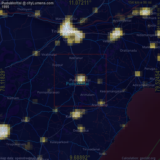
» NASA, Earths city lights 1995
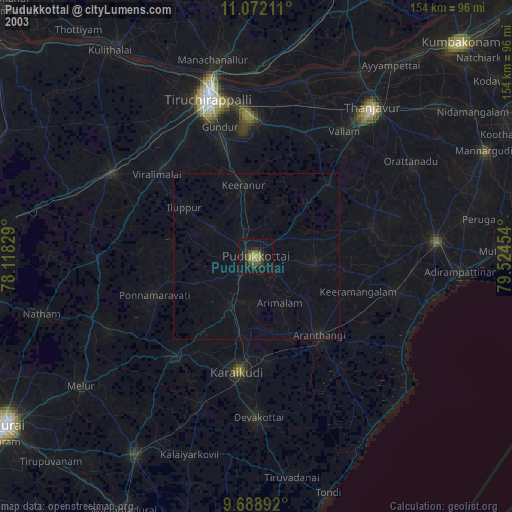
» NASA city lights 2003
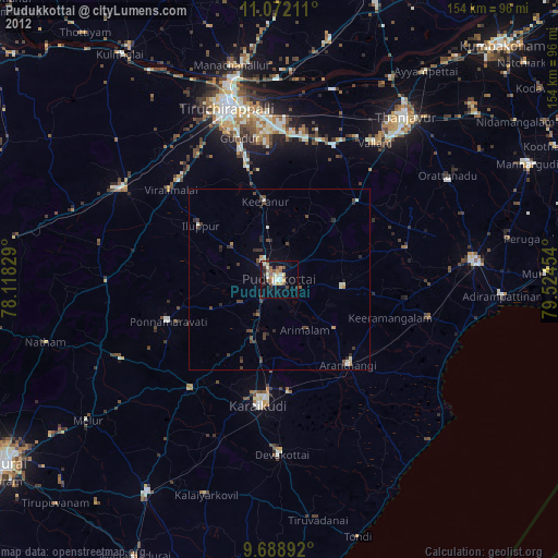
» Earth at Night: Flat Maps 2012, 2016