Puliyūr night lights from space
Night Light of Puliyūr (Tamil Nadu) from space (India) Src. Average luminocity for 10x10km area is 1.4339% and for 50x50km: 15.7006%.
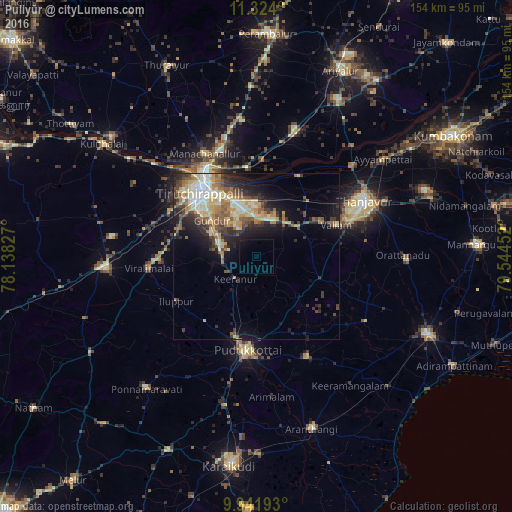
Analysis of Puliyūr night lights 2016
Square area 10x10 km:
 0%
0%90-99
0%80-89
0%70-79
0%60-69
0%50-59
0%40-49
0%30-39
0%20-29
0%10-19
2.48%0-9
97.52%Square area 50x50 km:
1.28%90-99
3.34%80-89
2.44%70-79
2.62%60-69
1.95%50-59
2.3%40-49
2.31%30-39
2.66%20-29
4.17%10-19
6.87%0-9
70.06%Clear (daylight) street map image can be seen on geolist.org.
Map coordinates:
11° 19' 26.4" North, 78° 8' 17.8" East
10° 38' 1.5" North, 78° 50' 29" East
9° 56' 30.9" North, 79° 32' 40.3" East
Some cities around Puliyūr sort by population:
• Tiruchirappalli
25.7 km =16 mi,  321°
321°
• Pudukkottai
28.2 km =17.5 mi,  184°
184°
• Lalgudi
26.8 km =16.7 mi,  354°
354°
• Vallam
25.7 km =16 mi,  68°
68°
• Iluppūr
27.3 km =17 mi,  240°
240°
• Thirukattupalli
26.6 km =16.5 mi,  28°
28°
• Kīranūr
9.3 km =5.8 mi,  220°
220°
• Annavāsal
24.7 km =15.3 mi, 218°
1259261 (p: 11,174)
Sources (retrieved 2019-11-25):
» Earth at Night: Flat Maps 2012, 2016