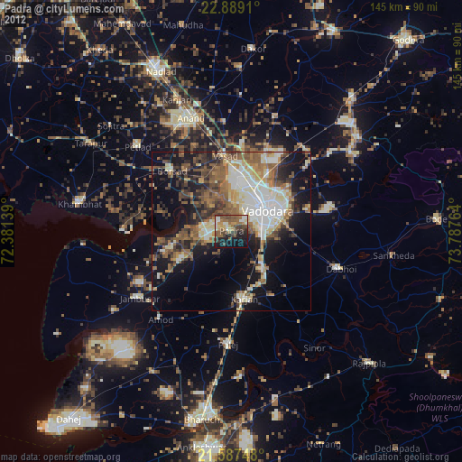
Padra night lights from space
Night Light of Padra (Gujarat) from space (India) Src. Average luminocity for 10x10km area is 50.2879% and for 50x50km: 37.401%.
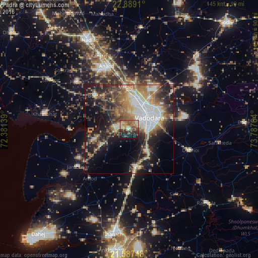
Analysis of Padra night lights 2016
Square area 10x10 km:
 0.76%
0.76%90-99
10.23%80-89
7.39%70-79
7.01%60-69
12.69%50-59
14.58%40-49
9.47%30-39
7.77%20-29
12.88%10-19
16.86%0-9
0.38%Square area 50x50 km:
5.24%90-99
7.92%80-89
4.13%70-79
4.47%60-69
6.26%50-59
6.82%40-49
6.09%30-39
6.4%20-29
9.44%10-19
15.26%0-9
27.97%Clear (daylight) street map image can be seen on geolist.org.
Map coordinates:
22° 53' 20.8" North, 72° 22' 53" East
22° 14' 23.3" North, 73° 5' 4.2" East
21° 35' 14.9" North, 73° 47' 15.5" East
Some cities around Padra sort by population:
• Vadodara
14.3 km =8.9 mi,  62°
62°
• Anand
37.2 km =23.1 mi,  339°
339°
• Borsad
26.8 km =16.7 mi,  314°
314°
• Dabhoi
36.5 km =22.7 mi,  99°
99°
• Jambusar
35.9 km =22.3 mi,  234°
234°
• Amod
35.2 km =21.9 mi,  218°
218°
• Vāghodia
33.3 km =20.7 mi,  77°
77°
• Dhuwaran
33.5 km =20.8 mi,  269°
269°
1260911 (p: 36,499)
Sources (retrieved 2019-11-25):
» Earth at Night: Flat Maps 2012, 2016