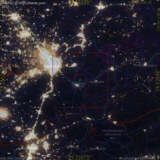
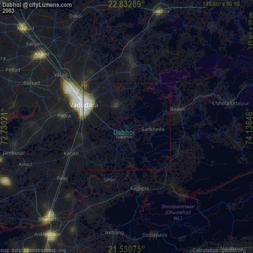
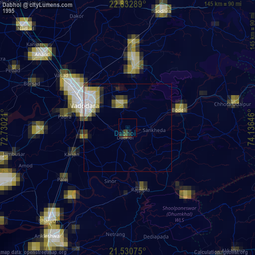
Dabhoi night lights from space
Night Light of Dabhoi (Gujarat) from space (India) Src. Average luminocity for 10x10km area is 4.6389% and for 50x50km: 11.8193%.
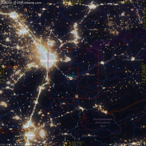
Analysis of Dabhoi night lights 2016
Square area 10x10 km:
 0%
0%90-99
0%80-89
1.59%70-79
0.4%60-69
0.4%50-59
1.98%40-49
0%30-39
0.79%20-29
1.19%10-19
0%0-9
93.65%Square area 50x50 km:
1.95%90-99
2.51%80-89
1.27%70-79
0.95%60-69
1.66%50-59
1.76%40-49
2.09%30-39
1.5%20-29
3.04%10-19
6.14%0-9
77.14%Clear (daylight) street map image can be seen on geolist.org.
Map coordinates:
22° 49' 58.4" North, 72° 43' 48.8" East
22° 10' 60" North, 73° 25' 60" East
21° 31' 50.7" North, 74° 8' 11.3" East
Some cities around Dabhoi sort by population:
• Vadodara
26.5 km =16.5 mi,  299°
299°
• Hālol
35.8 km =22.2 mi,  6°
6°
• Padra
36.5 km =22.7 mi,  279°
279°
• Rājpīpla
35.9 km =22.3 mi,  168°
168°
• Vāghodia
14 km =8.7 mi,  345°
345°
• Sankheda
15 km =9.3 mi,  95°
95°
• Sinor
31.8 km =19.8 mi,  197°
197°
• Shivrājpur
32.2 km =20 mi,  34°
34°
1273766 (p: 56,253)
Sources (retrieved 2019-11-25):
» NASA, Earths city lights 1995
» NASA city lights 2003
» Earth at Night: Flat Maps 2012, 2016