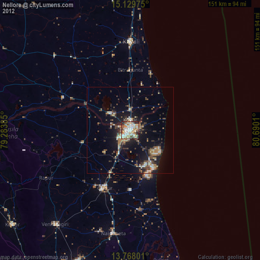
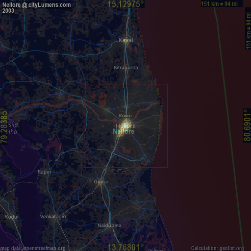
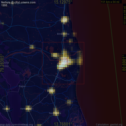
Nellore night lights from space
Night Light of Nellore (Andhra Pradesh) from space (India) Src. Average luminocity for 10x10km area is 79.8052% and for 50x50km: 22.7586%.

Analysis of Nellore night lights 2016
Square area 10x10 km:
 13.85%
90-99
35.06%80-89
17.32%70-79
4.33%60-69
5.41%50-59
8.44%40-49
10.61%30-39
4.11%20-29
0.87%10-19
0%0-9
0%Square area 50x50 km:
0.8%90-99
3.7%80-89
3.4%70-79
1.89%60-69
2.8%50-59
4.91%40-49
5.02%30-39
5.77%20-29
7.89%10-19
14.44%0-9
49.37%Clear (daylight) street map image can be seen on geolist.org.
Map coordinates:
15° 7' 47.1" North, 79° 17' 1.9" East
14° 26' 59.7" North, 79° 59' 13.1" East
13° 46' 4.8" North, 80° 41' 24.4" East
Some cities around Nellore sort by population:
• Kāvali
51.9 km =32.2 mi,  0°
0°
• Gūdūr
36.3 km =22.6 mi,  203°
203°
• Kandukūr
85.6 km =53.2 mi,  354°
354°
• Nāyudupet
61.1 km =38 mi,  189°
189°
• Sūlūru
83.4 km =51.8 mi,  177°
177°
• Kovūr
5.6 km =3.5 mi,  358°
358°
• Venkatagiri
69.9 km =43.4 mi,  218°
218°
• Vadlapūdi
25 km =15.5 mi,  231°
231°
1261529 (p: 404,158)
Sources (retrieved 2019-11-25):
» NASA, Earths city lights 1995
» NASA city lights 2003
» Earth at Night: Flat Maps 2012, 2016