Narela night lights from space
Night Light of Narela (Delhi) from space (India) Src. Average luminocity for 10x10km area is 88.2746% and for 50x50km: 59.4479%.
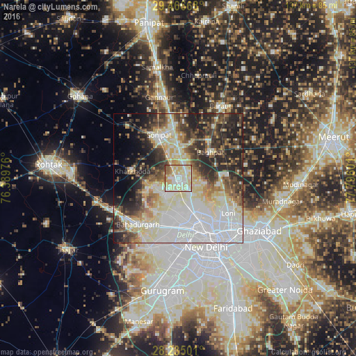
Analysis of Narela night lights 2016
Square area 10x10 km:
 21.02%
90-99
27.65%80-89
38.26%70-79
3.03%60-69
4.36%50-59
4.73%40-49
0.95%30-39
0%20-29
0%10-19
0%0-9
0%Square area 50x50 km:
19.18%90-99
12.55%80-89
11.05%70-79
3.89%60-69
4.7%50-59
5.78%40-49
6.41%30-39
7.73%20-29
11.47%10-19
8.05%0-9
9.18%Clear (daylight) street map image can be seen on geolist.org.
Map coordinates:
29° 28' 0" North, 76° 23' 23.1" East
28° 51' 9.6" North, 77° 5' 34.4" East
28° 14' 6" North, 77° 47' 45.6" East
Some cities around Narela sort by population:
• Rohini
12.4 km =7.7 mi,  191°
191°
• Sonīpat
17.3 km =10.7 mi,  335°
335°
• Nāngloi Jāt
19.4 km =12.1 mi, 187°
• Khekra
18.7 km =11.6 mi,  85°
85°
• Bāghpat
16 km =9.9 mi,  50°
50°
• Bawāna
8.3 km =5.2 mi,  223°
223°
• Kharkhauda
18 km =11.2 mi,  279°
279°
• Alīpur
7.2 km =4.5 mi,  146°
146°
1261809 (p: 800,000)
Sources (retrieved 2019-11-25):
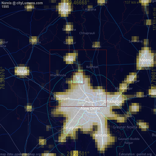
» NASA, Earths city lights 1995
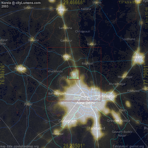
» NASA city lights 2003
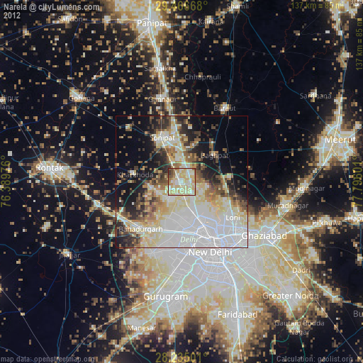
» Earth at Night: Flat Maps 2012, 2016