Kharkhauda night lights from space
Night Light of Kharkhauda (Haryana) from space (India) Src. Average luminocity for 10x10km area is 24.2879% and for 50x50km: 39.6219%.
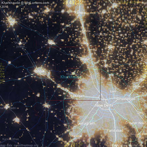
Analysis of Kharkhauda night lights 2016
Square area 10x10 km:
 0.38%
0.38%90-99
1.52%80-89
3.79%70-79
2.65%60-69
2.46%50-59
5.68%40-49
5.11%30-39
5.68%20-29
12.88%10-19
26.14%0-9
33.71%Square area 50x50 km:
9.51%90-99
9.01%80-89
8.48%70-79
3.08%60-69
3.26%50-59
4.33%40-49
4.38%30-39
5.06%20-29
6.2%10-19
10.62%0-9
36.07%Clear (daylight) street map image can be seen on geolist.org.
Map coordinates:
29° 29' 33.2" North, 76° 12' 27.3" East
28° 52' 43.3" North, 76° 54' 38.5" East
28° 15' 40.3" North, 77° 36' 49.8" East
Some cities around Kharkhauda sort by population:
• Rohini
21.5 km =13.4 mi,  134°
134°
• Narela
18 km =11.2 mi,  99°
99°
• Sonīpat
16.7 km =10.4 mi,  39°
39°
• Nāngloi Jāt
26.9 km =16.7 mi,  145°
145°
• Bahādurgarh
20.8 km =12.9 mi,  173°
173°
• Bawāna
15 km =9.3 mi, 126°
• Alīpur
23.4 km =14.5 mi,  112°
112°
• Kheri Sāmpla
17.3 km =10.7 mi,  229°
229°
1266891 (p: 21,320)
Sources (retrieved 2019-11-25):
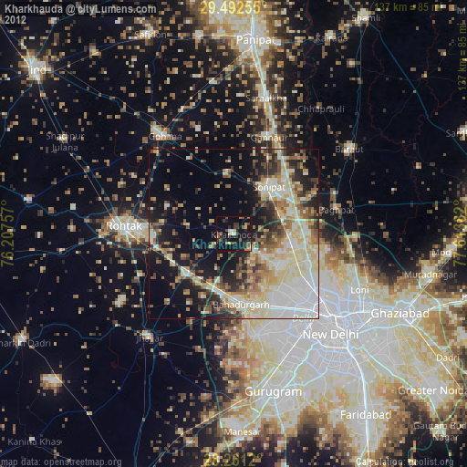
» Earth at Night: Flat Maps 2012, 2016