Bawāna night lights from space
Night Light of Bawāna (Delhi) from space (India) Src. Average luminocity for 10x10km area is 85.892% and for 50x50km: 59.5163%.
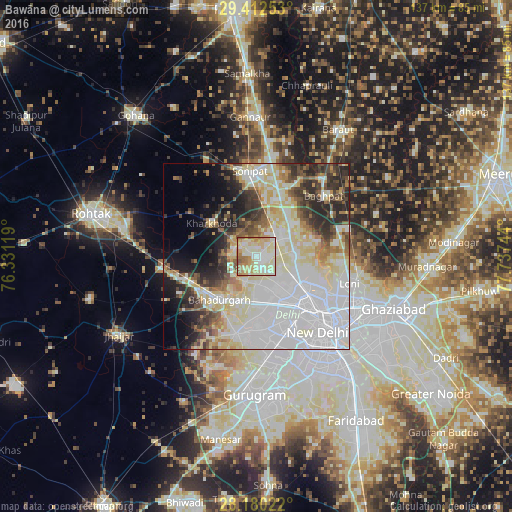
Analysis of Bawāna night lights 2016
Square area 10x10 km:
 13.64%
90-99
32.39%80-89
28.41%70-79
12.31%60-69
8.52%50-59
4.17%40-49
0.57%30-39
0%20-29
0%10-19
0%0-9
0%Square area 50x50 km:
22.27%90-99
13.13%80-89
11.25%70-79
3.69%60-69
4.03%50-59
4.51%40-49
4.58%30-39
5.6%20-29
8.08%10-19
6.93%0-9
15.92%Clear (daylight) street map image can be seen on geolist.org.
Map coordinates:
29° 24' 45.1" North, 76° 19' 52.3" East
28° 47' 53.5" North, 77° 2' 3.5" East
28° 10' 48.8" North, 77° 44' 14.8" East
Some cities around Bawāna sort by population:
• Najafgarh
21.7 km =13.5 mi,  194°
194°
• Rohini
6.9 km =4.3 mi,  151°
151°
• Narela
8.3 km =5.2 mi,  43°
43°
• Sonīpat
21.9 km =13.6 mi,  356°
356°
• Nāngloi Jāt
13.6 km =8.5 mi,  166°
166°
• Bahādurgarh
15.2 km =9.4 mi,  219°
219°
• Kharkhauda
15 km =9.3 mi,  306°
306°
• Alīpur
9.6 km =6 mi,  89°
89°
1276663 (p: 24,906)
Sources (retrieved 2019-11-25):
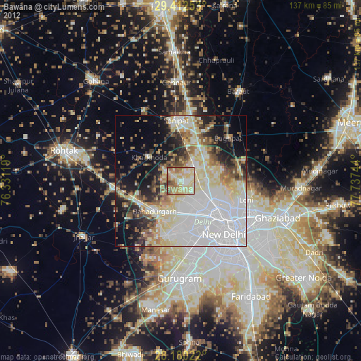
» Earth at Night: Flat Maps 2012, 2016