Rohini night lights from space
Night Light of Rohini (Delhi) from space (India) Src. Average luminocity for 10x10km area is 95.767% and for 50x50km: 68.3721%.
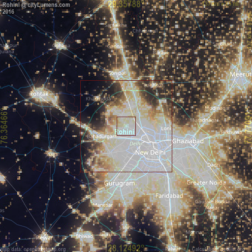
Analysis of Rohini night lights 2016
Square area 10x10 km:
 49.81%
90-99
29.92%80-89
18.75%70-79
1.52%60-69
0%50-59
0%40-49
0%30-39
0%20-29
0%10-19
0%0-9
0%Square area 50x50 km:
29.08%90-99
15.21%80-89
11.72%70-79
3.67%60-69
4.33%50-59
4.67%40-49
4.6%30-39
4.83%20-29
7.61%10-19
5.76%0-9
8.5%Clear (daylight) street map image can be seen on geolist.org.
Map coordinates:
29° 21' 28.4" North, 76° 21' 52.8" East
28° 44' 35.6" North, 77° 4' 4" East
28° 7' 29.7" North, 77° 46' 15.3" East
Some cities around Rohini sort by population:
• Delhi
18.9 km =11.7 mi,  122°
122°
• Najafgarh
17.2 km =10.7 mi,  209°
209°
• Narela
12.4 km =7.7 mi,  11°
11°
• Karol Bāgh
15.8 km =9.8 mi,  130°
130°
• Nāngloi Jāt
7.1 km =4.4 mi,  179°
179°
• Bahādurgarh
14.1 km =8.8 mi,  246°
246°
• Bawāna
6.9 km =4.3 mi,  331°
331°
• Alīpur
8.9 km =5.5 mi,  45°
45°
12069922 (p: 860,000)
Sources (retrieved 2019-11-25):
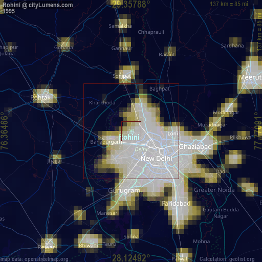
» NASA, Earths city lights 1995
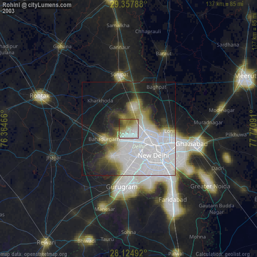
» NASA city lights 2003
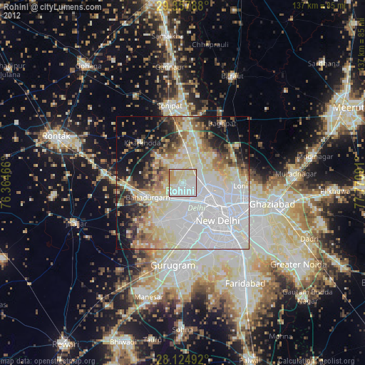
» Earth at Night: Flat Maps 2012, 2016