Khekra night lights from space
Night Light of Khekra (Uttar Pradesh) from space (India) Src. Average luminocity for 10x10km area is 48.8617% and for 50x50km: 62.348%.
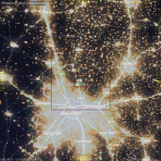
Analysis of Khekra night lights 2016
Square area 10x10 km:
 2.84%
2.84%90-99
9.66%80-89
4.17%70-79
5.68%60-69
6.44%50-59
8.14%40-49
22.73%30-39
10.42%20-29
28.6%10-19
1.33%0-9
0%Square area 50x50 km:
19.24%90-99
13.37%80-89
10.65%70-79
4.24%60-69
5.55%50-59
6.35%40-49
7.33%30-39
8.71%20-29
12.31%10-19
12.25%0-9
0.01%Clear (daylight) street map image can be seen on geolist.org.
Map coordinates:
29° 28' 47.2" North, 76° 34' 51.5" East
28° 51' 57.1" North, 77° 17' 2.8" East
28° 14' 53.8" North, 77° 59' 14" East
Some cities around Khekra sort by population:
• Delhi
24.3 km =15.1 mi,  192°
192°
• Rohini
25.1 km =15.6 mi,  237°
237°
• Narela
18.7 km =11.6 mi,  265°
265°
• Loni
12.7 km =7.9 mi,  177°
177°
• Murādnagar
22.9 km =14.2 mi,  114°
114°
• Bāghpat
10.9 km =6.8 mi,  324°
324°
• Alīpur
16.5 km =10.3 mi, 243°
• Niwāri
24.8 km =15.4 mi,  87°
87°
1266794 (p: 42,408)
Sources (retrieved 2019-11-25):
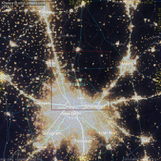
» Earth at Night: Flat Maps 2012, 2016