Mataundh night lights from space
Night Light of Mataundh (Uttar Pradesh) from space (India) Src. Average luminocity for 10x10km area is 2.7718% and for 50x50km: 6.1216%.
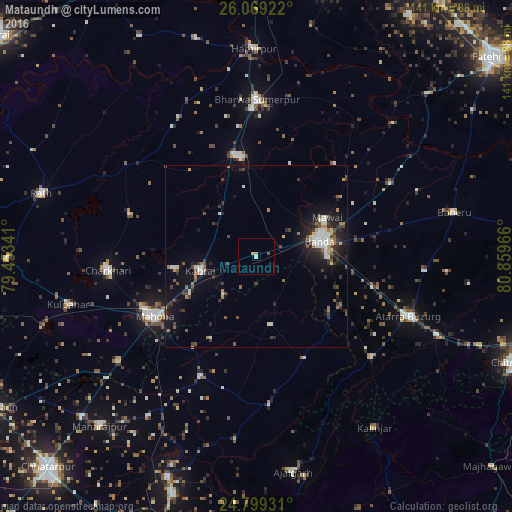
Analysis of Mataundh night lights 2016
Square area 10x10 km:
 0%
0%90-99
0.79%80-89
0.4%70-79
1.19%60-69
0%50-59
0.79%40-49
0%30-39
0%20-29
0%10-19
0%0-9
96.83%Square area 50x50 km:
0.71%90-99
1%80-89
0.39%70-79
0.51%60-69
0.81%50-59
0.7%40-49
1%30-39
1.28%20-29
1.76%10-19
4.67%0-9
87.16%Clear (daylight) street map image can be seen on geolist.org.
Map coordinates:
26° 4' 9.2" North, 79° 27' 12.3" East
25° 26' 9.4" North, 80° 9' 23.5" East
24° 47' 57.5" North, 80° 51' 34.8" East
Some cities around Mataundh sort by population:
• Bānda
18.5 km =11.5 mi,  75°
75°
• Mahobā
32.6 km =20.3 mi,  240°
240°
• Maudaha
27.8 km =17.3 mi,  351°
351°
• Charkhāri
41.1 km =25.5 mi,  264°
264°
• Kabrāi
16.2 km =10.1 mi, 256°
• Naraini
42.1 km =26.2 mi,  130°
130°
• Kharela
36.5 km =22.7 mi,  288°
288°
• Chandla
40.7 km =25.3 mi,  174°
174°
1263384 (p: 8,591)
Sources (retrieved 2019-11-25):
» Earth at Night: Flat Maps 2012, 2016