Chandla night lights from space
Night Light of Chandla (Madhya Pradesh) from space (India) Src. Average luminocity for 10x10km area is 2.3125% and for 50x50km: 2.3742%.
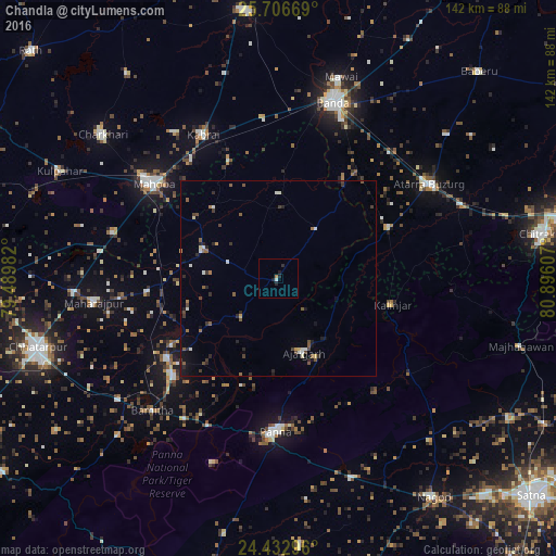
Analysis of Chandla night lights 2016
Square area 10x10 km:
 0.38%
0.38%90-99
0.38%80-89
0%70-79
0%60-69
0.76%50-59
0%40-49
0%30-39
0%20-29
2.46%10-19
1.33%0-9
94.7%Square area 50x50 km:
0.22%90-99
0.3%80-89
0.15%70-79
0.11%60-69
0.22%50-59
0.57%40-49
0.37%30-39
0.47%20-29
0.81%10-19
0.95%0-9
95.84%Clear (daylight) street map image can be seen on geolist.org.
Map coordinates:
25° 42' 24.1" North, 79° 29' 23.4" East
25° 4' 17.3" North, 80° 11' 34.6" East
24° 25' 58.7" North, 80° 53' 45.9" East
Some cities around Chandla sort by population:
• Mahobā
40.2 km =25 mi,  307°
307°
• Panna
39 km =24.2 mi,  180°
180°
• Khajuraho Group of Monuments
36.1 km =22.4 mi,  226°
226°
• Kabrāi
41.7 km =25.9 mi,  332°
332°
• Naraini
31.3 km =19.4 mi,  65°
65°
• Ajaigarh
20.3 km =12.6 mi,  160°
160°
• Rājnagar
34.8 km =21.6 mi, 234°
• Mataundh
40.7 km =25.3 mi,  354°
354°
1274735 (p: 11,195)
Sources (retrieved 2019-11-25):
» Earth at Night: Flat Maps 2012, 2016