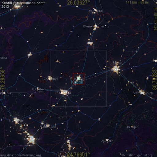
Kabrāi night lights from space
Night Light of Kabrāi (Uttar Pradesh) from space (India) Src. Average luminocity for 10x10km area is 17.8929% and for 50x50km: 5.0429%.
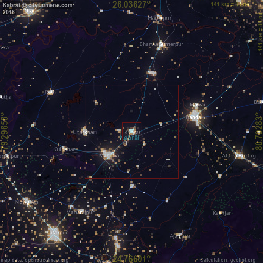
Analysis of Kabrāi night lights 2016
Square area 10x10 km:
 2.38%
2.38%90-99
2.18%80-89
0.2%70-79
0.2%60-69
4.96%50-59
1.59%40-49
4.37%30-39
1.98%20-29
3.57%10-19
17.06%0-9
61.51%Square area 50x50 km:
0.58%90-99
0.78%80-89
0.26%70-79
0.36%60-69
0.72%50-59
0.69%40-49
1.05%30-39
0.71%20-29
1.07%10-19
3.79%0-9
90%Clear (daylight) street map image can be seen on geolist.org.
Map coordinates:
26° 2' 10.6" North, 79° 17' 47.7" East
25° 24' 10.1" North, 79° 59' 58.9" East
24° 45' 57.6" North, 80° 42' 10.2" East
Some cities around Kabrāi sort by population:
• Bānda
34.7 km =21.6 mi,  76°
76°
• Mahobā
17.7 km =11 mi,  225°
225°
• Maudaha
33.2 km =20.6 mi,  20°
20°
• Charkhāri
25.2 km =15.7 mi,  270°
270°
• Kulpahār
37.4 km =23.2 mi,  255°
255°
• Kharela
24.4 km =15.2 mi,  309°
309°
• Chandla
41.7 km =25.9 mi,  152°
152°
• Mataundh
16.2 km =10.1 mi, 76°
1268739 (p: 24,771)
Sources (retrieved 2019-11-25):
» Earth at Night: Flat Maps 2012, 2016