Kharela night lights from space
Night Light of Kharela (Uttar Pradesh) from space (India) Src. Average luminocity for 10x10km area is 3.6746% and for 50x50km: 3.687%.
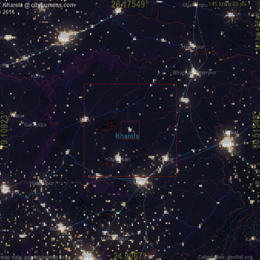
Analysis of Kharela night lights 2016
Square area 10x10 km:
 0.2%
0.2%90-99
0.6%80-89
0.79%70-79
0%60-69
0.79%50-59
0.2%40-49
2.18%30-39
0%20-29
0.6%10-19
0.2%0-9
94.44%Square area 50x50 km:
0.31%90-99
0.57%80-89
0.19%70-79
0.23%60-69
0.53%50-59
0.41%40-49
0.86%30-39
0.6%20-29
0.79%10-19
2.29%0-9
93.22%Clear (daylight) street map image can be seen on geolist.org.
Map coordinates:
26° 10' 31.8" North, 79° 6' 33.2" East
25° 32' 34" North, 79° 48' 44.5" East
24° 54' 24.1" North, 80° 30' 55.7" East
Some cities around Kharela sort by population:
• Mahobā
28.8 km =17.9 mi,  167°
167°
• Rāth
25.3 km =15.7 mi,  283°
283°
• Maudaha
34.1 km =21.2 mi,  62°
62°
• Charkhāri
16.8 km =10.4 mi,  202°
202°
• Kabrāi
24.4 km =15.2 mi,  129°
129°
• Kulpahār
30.3 km =18.8 mi,  215°
215°
• Sarīla
29.3 km =18.2 mi,  332°
332°
• Gohānd
31.9 km =19.8 mi,  302°
302°
1266937 (p: 13,798)
Sources (retrieved 2019-11-25):
» Earth at Night: Flat Maps 2012, 2016