Madhupur night lights from space
Night Light of Madhupur (Jharkhand) from space (India) Src. Average luminocity for 10x10km area is 60.1951% and for 50x50km: 17.6945%.
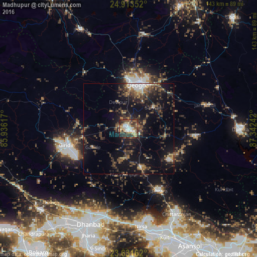
Analysis of Madhupur night lights 2016
Square area 10x10 km:
 9.66%
9.66%90-99
11.93%80-89
7.95%70-79
11.74%60-69
5.68%50-59
9.09%40-49
15.34%30-39
13.45%20-29
11.93%10-19
3.22%0-9
0%Square area 50x50 km:
1.44%90-99
1.67%80-89
1.26%70-79
1.51%60-69
1.93%50-59
3.3%40-49
4.95%30-39
5.35%20-29
5.92%10-19
15.92%0-9
56.75%Clear (daylight) street map image can be seen on geolist.org.
Map coordinates:
24° 54' 48.7" North, 85° 56' 10.2" East
24° 16' 27.1" North, 86° 38' 21.4" East
23° 37' 53.8" North, 87° 20' 32.7" East
Some cities around Madhupur sort by population:
• Dhanbād
56.2 km =34.9 mi,  200°
200°
• Gīrīdīh
34.9 km =21.7 mi,  253°
253°
• Chittaranjan
53.6 km =33.3 mi,  149°
149°
• Jāmtāra
38.4 km =23.9 mi, 154°
• Jasidih
26.6 km =16.5 mi,  1°
1°
• Nirsā
54.9 km =34.1 mi,  172°
172°
• Gobindpur
50.3 km =31.3 mi,  194°
194°
• Topchānchi
60.9 km =37.8 mi,  227°
227°
1264551 (p: 50,671)
Sources (retrieved 2019-11-25):
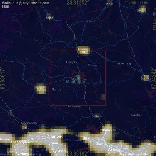
» NASA, Earths city lights 1995
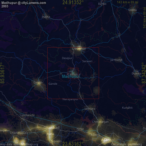
» NASA city lights 2003
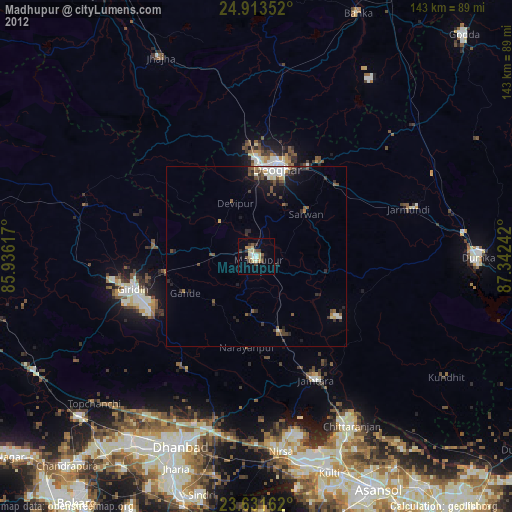
» Earth at Night: Flat Maps 2012, 2016