Gīrīdīh night lights from space
Night Light of Gīrīdīh (Jharkhand) from space (India) Src. Average luminocity for 10x10km area is 84.072% and for 50x50km: 10.6777%.
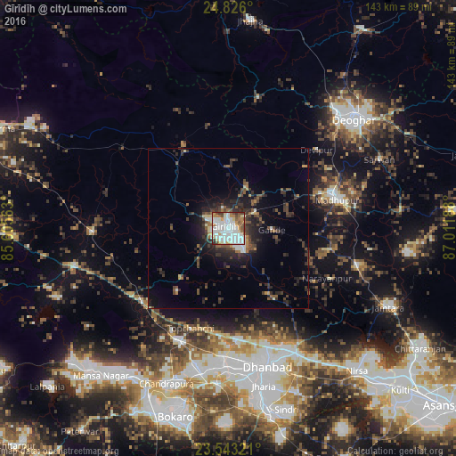
Analysis of Gīrīdīh night lights 2016
Square area 10x10 km:
 31.25%
90-99
29.92%80-89
7.39%70-79
5.3%60-69
8.33%50-59
6.63%40-49
5.87%30-39
4.17%20-29
1.14%10-19
0%0-9
0%Square area 50x50 km:
1.59%90-99
1.68%80-89
0.67%70-79
0.56%60-69
1.15%50-59
1.62%40-49
2.1%30-39
2.84%20-29
4.03%10-19
5.8%0-9
77.97%Clear (daylight) street map image can be seen on geolist.org.
Map coordinates:
24° 49' 33.6" North, 85° 36' 20.3" East
24° 11' 10.4" North, 86° 18' 31.5" East
23° 32' 35.6" North, 87° 0' 42.8" East
Some cities around Gīrīdīh sort by population:
• Dhanbād
44.9 km =27.9 mi,  162°
162°
• Kātrās
43.2 km =26.8 mi,  181°
181°
• Madhupur
34.9 km =21.7 mi,  73°
73°
• Gomoh
38.3 km =23.8 mi,  204°
204°
• Barki Saria
42.6 km =26.5 mi,  268°
268°
• Gobindpur
44.4 km =27.6 mi,  151°
151°
• Dhanwār
41.5 km =25.8 mi,  306°
306°
• Topchānchi
33.4 km =20.8 mi, 199°
1271175 (p: 60,000)
Sources (retrieved 2019-11-25):
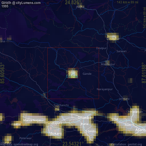
» NASA, Earths city lights 1995
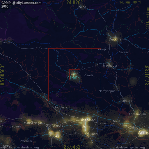
» NASA city lights 2003
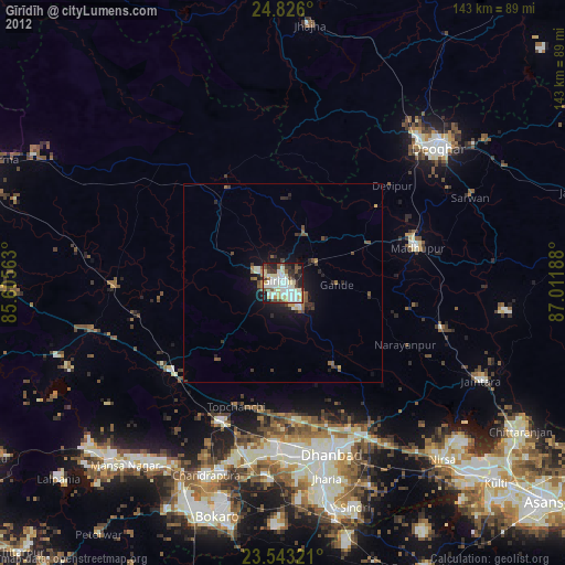
» Earth at Night: Flat Maps 2012, 2016