Jāmtāra night lights from space
Night Light of Jāmtāra (Jharkhand) from space (India) Src. Average luminocity for 10x10km area is 33.7348% and for 50x50km: 27.6377%.
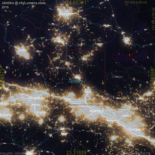
Analysis of Jāmtāra night lights 2016
Square area 10x10 km:
 5.49%
5.49%90-99
5.87%80-89
1.33%70-79
3.22%60-69
2.46%50-59
5.68%40-49
5.49%30-39
7.2%20-29
14.77%10-19
39.58%0-9
8.9%Square area 50x50 km:
5.1%90-99
5.32%80-89
2.35%70-79
2.85%60-69
3.35%50-59
4.35%40-49
4.96%30-39
5.01%20-29
6.23%10-19
15.04%0-9
45.45%Clear (daylight) street map image can be seen on geolist.org.
Map coordinates:
24° 36' 14.1" North, 86° 5' 59" East
23° 57' 46.8" North, 86° 48' 10.3" East
23° 19' 8" North, 87° 30' 21.5" East
Some cities around Jāmtāra sort by population:
• Āsansol
36.1 km =22.4 mi,  149°
149°
• Kulti
26.1 km =16.2 mi,  170°
170°
• Jāmuria
40.2 km =25 mi,  135°
135°
• Madhupur
38.4 km =23.9 mi,  334°
334°
• Chittaranjan
15.6 km =9.7 mi, 139°
• Lakhyabad
35.7 km =22.2 mi,  202°
202°
• Nirsā
22.1 km =13.7 mi,  206°
206°
• Gobindpur
32.2 km =20 mi,  243°
243°
1269298 (p: 24,388)
Sources (retrieved 2019-11-25):
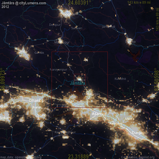
» Earth at Night: Flat Maps 2012, 2016