Dhanbād night lights from space
Night Light of Dhanbād (Jharkhand) from space (India) Src. Average luminocity for 10x10km area is 97.4921% and for 50x50km: 46.9488%.
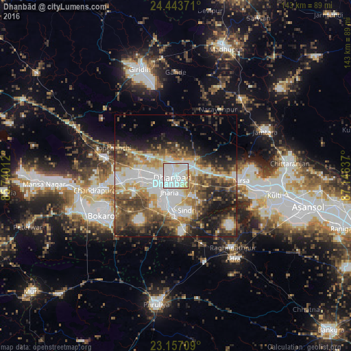
Analysis of Dhanbād night lights 2016
Square area 10x10 km:
 56.35%
90-99
33.53%80-89
8.93%70-79
1.19%60-69
0%50-59
0%40-49
0%30-39
0%20-29
0%10-19
0%0-9
0%Square area 50x50 km:
11.34%90-99
9.99%80-89
4.83%70-79
5.46%60-69
6.11%50-59
6.82%40-49
7.9%30-39
7.44%20-29
8.17%10-19
10.72%0-9
21.22%Clear (daylight) street map image can be seen on geolist.org.
Map coordinates:
24° 26' 37.4" North, 85° 44' 24.4" East
23° 48' 7.2" North, 86° 26' 35.7" East
23° 9' 25.5" North, 87° 8' 46.9" East
Some cities around Dhanbād sort by population:
• Jharia
7.4 km =4.6 mi,  203°
203°
• Kātrās
14.7 km =9.1 mi,  268°
268°
• Pāthardih
15.2 km =9.4 mi,  184°
184°
• Jāmadoba
10.5 km =6.5 mi, 204°
• Sijua
11.8 km =7.3 mi,  255°
255°
• Bagra
15 km =9.3 mi,  239°
239°
• Gobindpur
8.5 km =5.3 mi,  64°
64°
• Kenduadīh
7.4 km =4.6 mi,  246°
246°
1272979 (p: 219,636)
Sources (retrieved 2019-11-25):
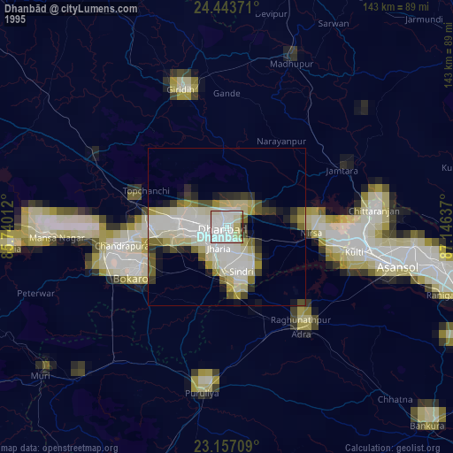
» NASA, Earths city lights 1995
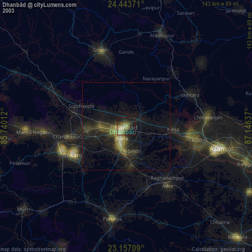
» NASA city lights 2003
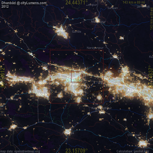
» Earth at Night: Flat Maps 2012, 2016