Chittaranjan night lights from space
Night Light of Chittaranjan (West Bengal) from space (India) Src. Average luminocity for 10x10km area is 68.129% and for 50x50km: 40.5248%.
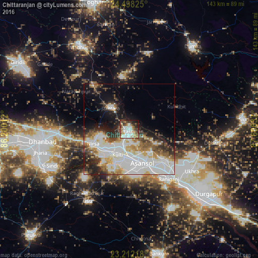
Analysis of Chittaranjan night lights 2016
Square area 10x10 km:
 18.65%
90-99
20.24%80-89
6.75%70-79
6.35%60-69
6.55%50-59
9.92%40-49
8.53%30-39
9.92%20-29
7.94%10-19
4.76%0-9
0.4%Square area 50x50 km:
12.68%90-99
11.52%80-89
3.5%70-79
3.31%60-69
3.58%50-59
4.04%40-49
4.06%30-39
4.35%20-29
5.43%10-19
10.06%0-9
37.48%Clear (daylight) street map image can be seen on geolist.org.
Map coordinates:
24° 29' 53.7" North, 86° 12' 0.4" East
23° 51' 24.5" North, 86° 54' 11.7" East
23° 12' 43.8" North, 87° 36' 22.9" East
Some cities around Chittaranjan sort by population:
• Āsansol
20.9 km =13 mi,  157°
157°
• Kulti
15.2 km =9.4 mi,  203°
203°
• Jāmuria
24.6 km =15.3 mi,  133°
133°
• Rānīganj
35.4 km =22 mi,  139°
139°
• Lakhyabad
32 km =19.9 mi,  228°
228°
• Jāmtāra
15.6 km =9.7 mi,  319°
319°
• Bahula
35 km =21.7 mi, 130°
• Nirsā
21.5 km =13.4 mi,  248°
248°
1274043 (p: 45,305)
Sources (retrieved 2019-11-25):
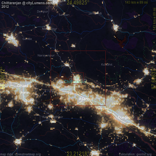
» Earth at Night: Flat Maps 2012, 2016