Bahādurgarh night lights from space
Night Light of Bahādurgarh (Haryana) from space (India) Src. Average luminocity for 10x10km area is 76.6345% and for 50x50km: 54.19%.
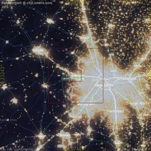
Analysis of Bahādurgarh night lights 2016
Square area 10x10 km:
 12.88%
90-99
17.42%80-89
31.63%70-79
5.87%60-69
7.77%50-59
8.9%40-49
7.95%30-39
6.82%20-29
0.76%10-19
0%0-9
0%Square area 50x50 km:
20.33%90-99
13.35%80-89
9.83%70-79
3.07%60-69
3.71%50-59
4.22%40-49
3.41%30-39
3.58%20-29
4.62%10-19
8.14%0-9
25.74%Clear (daylight) street map image can be seen on geolist.org.
Map coordinates:
29° 18' 28.2" North, 76° 13' 56.7" East
28° 41' 34.3" North, 76° 56' 8" East
28° 4' 27.4" North, 77° 38' 19.2" East
Some cities around Bahādurgarh sort by population:
• Najafgarh
10.3 km =6.4 mi,  155°
155°
• Rohini
14.1 km =8.8 mi,  66°
66°
• Narela
23.5 km =14.6 mi,  40°
40°
• Nāngloi Jāt
13 km =8.1 mi,  96°
96°
• Bawāna
15.2 km =9.4 mi, 39°
• Kharkhauda
20.8 km =12.9 mi,  353°
353°
• Alīpur
22.6 km =14 mi,  58°
58°
• Kheri Sāmpla
18.2 km =11.3 mi,  301°
301°
1277835 (p: 153,613)
Sources (retrieved 2019-11-25):
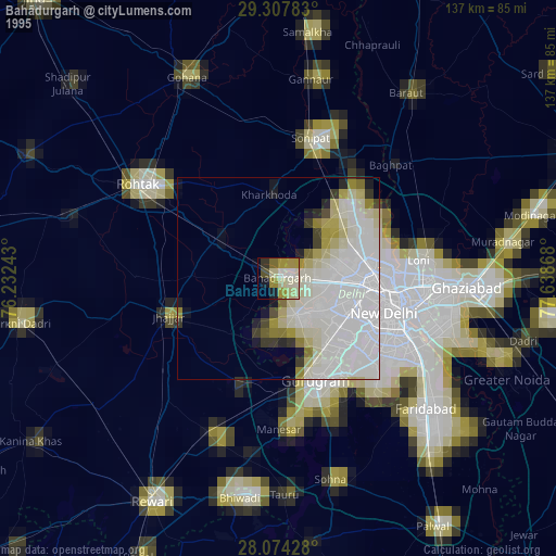
» NASA, Earths city lights 1995
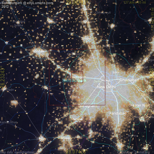
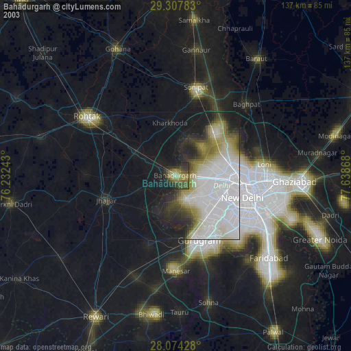
» NASA city lights 2003
» Earth at Night: Flat Maps 2012, 2016