Dahegām night lights from space
Night Light of Dahegām (Gujarat) from space (India) Src. Average luminocity for 10x10km area is 28.4848% and for 50x50km: 32.1169%.
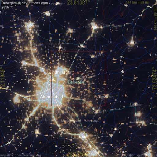
Analysis of Dahegām night lights 2016
Square area 10x10 km:
 0%
0%90-99
2.27%80-89
1.89%70-79
4.55%60-69
3.22%50-59
7.01%40-49
7.58%30-39
7.77%20-29
8.9%10-19
48.48%0-9
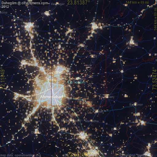
8.33%Square area 50x50 km:
7.43%90-99
5.49%80-89
3.04%70-79
2.75%60-69
4.35%50-59
5.18%40-49
5.45%30-39
4.81%20-29
6.59%10-19
16.89%0-9
38%Clear (daylight) street map image can be seen on geolist.org.
Map coordinates:
23° 48' 49.9" North, 72° 7' 6.6" East
23° 10' 8.5" North, 72° 49' 17.8" East
22° 31' 15.8" North, 73° 31' 29.1" East
Some cities around Dahegām sort by population:
• Ahmedabad
28.8 km =17.9 mi,  236°
236°
• Gandhinagar
15.1 km =9.4 mi,  290°
290°
• Kapadvanj
30.2 km =18.8 mi,  122°
122°
• Sarkhej
38.7 km =24 mi, 237°
• Mānsa
33.1 km =20.6 mi,  329°
329°
• Chhala
16.2 km =10.1 mi,  342°
342°
• Adalaj
24.6 km =15.3 mi,  268°
268°
• Naroda
20.1 km =12.5 mi, 236°
1273704 (p: 40,671)
Sources (retrieved 2019-11-25):
» Earth at Night: Flat Maps 2012, 2016