Gandhinagar night lights from space
Night Light of Gandhinagar (Gujarat) from space (India) Src. Average luminocity for 10x10km area is 79.0303% and for 50x50km: 42.6459%.
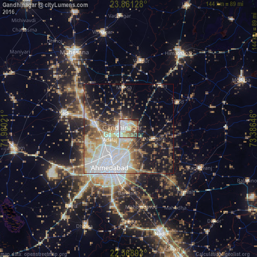
Analysis of Gandhinagar night lights 2016
Square area 10x10 km:
 20.08%
90-99
26.89%80-89
13.83%70-79
5.11%60-69
12.31%50-59
10.61%40-49
5.3%30-39
1.7%20-29
4.17%10-19
0%0-9
0%Square area 50x50 km:
10.91%90-99
9.17%80-89
4.98%70-79
4.2%60-69
5.19%50-59
5.75%40-49
5.61%30-39
5.24%20-29
6.9%10-19
15.9%0-9
26.15%Clear (daylight) street map image can be seen on geolist.org.
Map coordinates:
23° 51' 40.6" North, 71° 58' 48.8" East
23° 13' 0" North, 72° 40' 60" East
22° 34' 8.1" North, 73° 23' 11.3" East
Some cities around Gandhinagar sort by population:
• Ahmedabad
23.4 km =14.5 mi,  204°
204°
• Dahegām
15.1 km =9.4 mi,  110°
110°
• Sarkhej
31.9 km =19.8 mi,  215°
215°
• Mānsa
23.4 km =14.5 mi,  353°
353°
• Chhala
13.7 km =8.5 mi,  42°
42°
• Adalaj
12 km =7.5 mi,  240°
240°
• Jhulasan
24.8 km =15.4 mi,  300°
300°
• Naroda
16.5 km =10.3 mi,  189°
189°
1271715 (p: 195,985)
Sources (retrieved 2019-11-25):
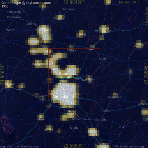
» NASA, Earths city lights 1995
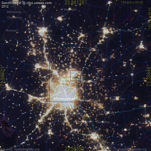
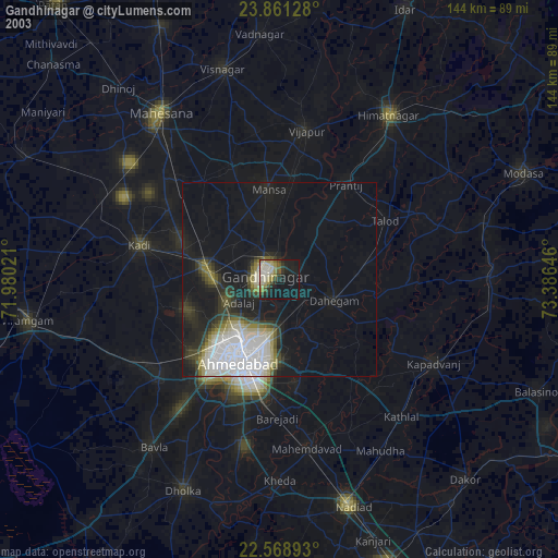
» NASA city lights 2003
» Earth at Night: Flat Maps 2012, 2016