Ahmedabad night lights from space
Night Light of Ahmedabad (Gujarat) from space (India) Src. Average luminocity for 10x10km area is 99.8254% and for 50x50km: 54.7928%.
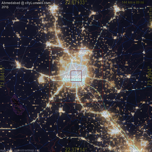
Analysis of Ahmedabad night lights 2016
Square area 10x10 km:
 94.64%
90-99
5.36%80-89
0%70-79
0%60-69
0%50-59
0%40-49
0%30-39
0%20-29
0%10-19
0%0-9
0%Square area 50x50 km:
12.9%90-99
12.11%80-89
7.1%70-79
5.82%60-69
7.39%50-59
7.75%40-49
7.18%30-39
6.99%20-29
11.37%10-19
16.16%0-9
5.23%Clear (daylight) street map image can be seen on geolist.org.
Map coordinates:
23° 40' 16.8" North, 71° 53' 2.9" East
23° 1' 32.8" North, 72° 35' 14.2" East
22° 22' 37.7" North, 73° 17' 25.4" East
Some cities around Ahmedabad sort by population:
• Gandhinagar
23.4 km =14.5 mi,  24°
24°
• Dahegām
28.8 km =17.9 mi,  56°
56°
• Sānand
21.4 km =13.3 mi,  259°
259°
• Mahemdāvād
28.3 km =17.6 mi,  142°
142°
• Sarkhej
9.9 km =6.2 mi,  241°
241°
• Kheda
32 km =19.9 mi,  161°
161°
• Adalaj
15.4 km =9.6 mi,  357°
357°
• Naroda
8.7 km =5.4 mi, 55°
1279233 (p: 3,719,710)
Sources (retrieved 2019-11-25):
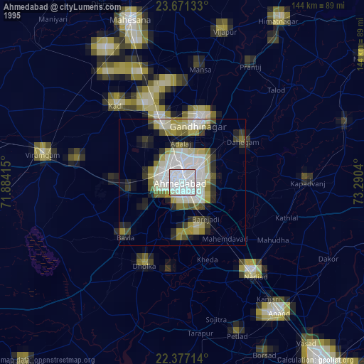
» NASA, Earths city lights 1995
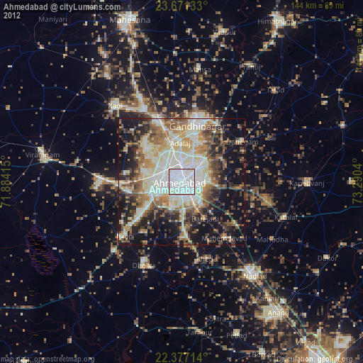
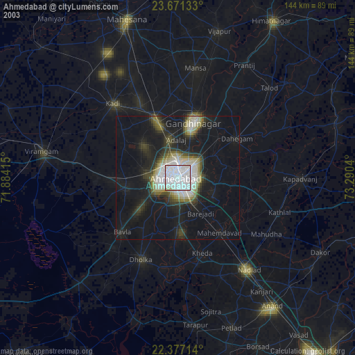
» NASA city lights 2003
» Earth at Night: Flat Maps 2012, 2016