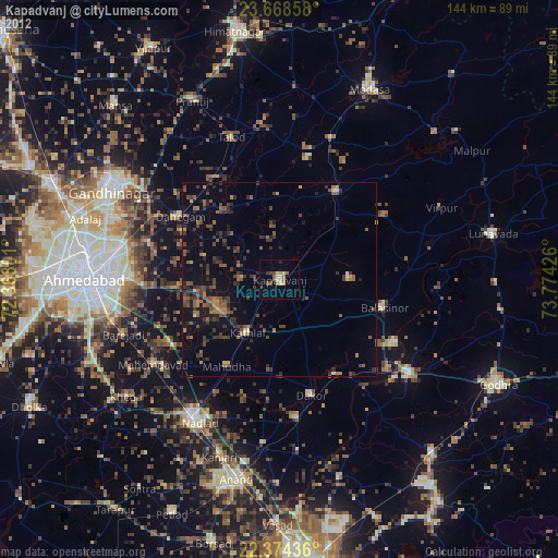
Kapadvanj night lights from space
Night Light of Kapadvanj (Gujarat) from space (India) Src. Average luminocity for 10x10km area is 15.1429% and for 50x50km: 9.7148%.
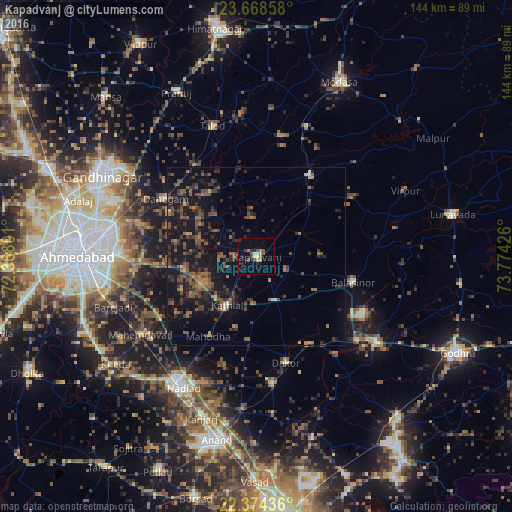
Analysis of Kapadvanj night lights 2016
Square area 10x10 km:
 0%
0%90-99
2.58%80-89
0.79%70-79
1.79%60-69
1.98%50-59
3.17%40-49
2.78%30-39
3.17%20-29
4.37%10-19
2.18%0-9
77.18%Square area 50x50 km:
0%90-99
0.4%80-89
0.26%70-79
0.73%60-69
1.52%50-59
2.79%40-49
2.91%30-39
3.16%20-29
3.6%10-19
11.01%0-9
73.61%Clear (daylight) street map image can be seen on geolist.org.
Map coordinates:
23° 40' 6.9" North, 72° 22' 4.8" East
23° 1' 22.9" North, 73° 4' 16.1" East
22° 22' 27.7" North, 73° 46' 27.3" East
Some cities around Kapadvanj sort by population:
• Nadiād
42.4 km =26.3 mi,  210°
210°
• Dahegām
30.2 km =18.8 mi,  302°
302°
• Umreth
36.3 km =22.6 mi,  172°
172°
• Mahemdāvād
39.2 km =24.4 mi,  235°
235°
• Dākor
31.1 km =19.3 mi, 165°
• Thāsra
28.8 km =17.9 mi,  150°
150°
• Mahudha
26.2 km =16.3 mi, 210°
• Naroda
42.7 km =26.5 mi,  277°
277°
1267939 (p: 44,764)
Sources (retrieved 2019-11-25):
» Earth at Night: Flat Maps 2012, 2016