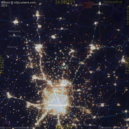
Mānsa night lights from space
Night Light of Mānsa (Gujarat) from space (India) Src. Average luminocity for 10x10km area is 18.7311% and for 50x50km: 18.3686%.
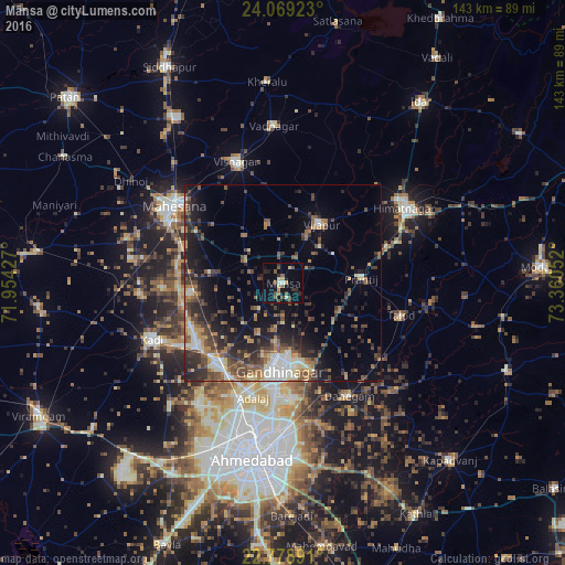
Analysis of Mānsa night lights 2016
Square area 10x10 km:
 0.76%
0.76%90-99
1.52%80-89
0.76%70-79
3.79%60-69
0.57%50-59
5.11%40-49
4.92%30-39
3.22%20-29
2.08%10-19
16.67%0-9
60.61%Square area 50x50 km:
1.42%90-99
2.68%80-89
1.51%70-79
1.74%60-69
3.03%50-59
3.76%40-49
3.77%30-39
4.3%20-29
6.09%10-19
10.41%0-9
61.28%Clear (daylight) street map image can be seen on geolist.org.
Map coordinates:
24° 4' 9.2" North, 71° 57' 15.4" East
23° 25' 32.3" North, 72° 39' 26.6" East
22° 46' 44.1" North, 73° 21' 37.9" East
Some cities around Mānsa sort by population:
• Gandhinagar
23.4 km =14.5 mi,  173°
173°
• Visnagar
32.2 km =20 mi,  340°
340°
• Kadi
35.9 km =22.3 mi,  246°
246°
• Dahegām
33.1 km =20.6 mi,  149°
149°
• Vijāpur
17.8 km =11.1 mi,  31°
31°
• Chhala
17.7 km =11 mi,  137°
137°
• Adalaj
30.1 km =18.7 mi,  195°
195°
• Jhulasan
21.7 km =13.5 mi,  240°
240°
1263623 (p: 29,551)
Sources (retrieved 2019-11-25):
» Earth at Night: Flat Maps 2012, 2016