Bhadarwāh night lights from space
Night Light of Bhadarwāh (Jammu and Kashmir) from space (India) Src. Average luminocity for 10x10km area is 1.9084% and for 50x50km: 0.4677%.
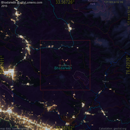
Analysis of Bhadarwāh night lights 2016
Square area 10x10 km:
 0%
0%90-99
0%80-89
0%70-79
0.73%60-69
0.18%50-59
0.55%40-49
0.73%30-39
0.73%20-29
0.73%10-19
0%0-9
96.34%Square area 50x50 km:
0.01%90-99
0.02%80-89
0%70-79
0.06%60-69
0.08%50-59
0.2%40-49
0.17%30-39
0.16%20-29
0.17%10-19
0.11%0-9
99.02%Clear (daylight) street map image can be seen on geolist.org.
Map coordinates:
33° 34' 2.1" North, 75° 0' 50.8" East
32° 58' 45.9" North, 75° 43' 2" East
32° 23' 15.4" North, 76° 25' 13.3" East
Some cities around Bhadarwāh sort by population:
• Udhampur
54.6 km =33.9 mi,  263°
263°
• Kathua
70.2 km =43.6 mi,  194°
194°
• Chamba
60.7 km =37.7 mi,  140°
140°
• Kishtwār
37.4 km =23.2 mi,  7°
7°
• Doda
24.6 km =15.3 mi,  320°
320°
• Rāmnagar
42.5 km =26.4 mi,  243°
243°
• Dalhousie
52.1 km =32.4 mi,  155°
155°
• Rāmban
53.6 km =33.3 mi,  303°
303°
1276358 (p: 13,429)
Sources (retrieved 2019-11-25):
» Earth at Night: Flat Maps 2012, 2016