Bettiah night lights from space
Night Light of Bettiah (Bihar) from space (India) Src. Average luminocity for 10x10km area is 49.0496% and for 50x50km: 11.5892%.
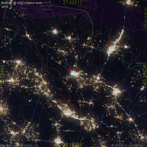
Analysis of Bettiah night lights 2016
Square area 10x10 km:
 16.07%
90-99
11.31%80-89
0.4%70-79
2.38%60-69
2.78%50-59
1.98%40-49
8.73%30-39
10.71%20-29
26.39%10-19
17.86%0-9
1.39%Square area 50x50 km:
0.81%90-99
0.87%80-89
0.39%70-79
0.72%60-69
1.39%50-59
1.83%40-49
3.16%30-39
3.99%20-29
6.36%10-19
10.16%0-9
70.32%Clear (daylight) street map image can be seen on geolist.org.
Map coordinates:
27° 25' 41.3" North, 83° 47' 60" East
26° 48' 8.2" North, 84° 30' 11.2" East
26° 10' 22.7" North, 85° 12' 22.5" East
Some cities around Bettiah sort by population:
• Birgañj, NP
44.4 km =27.6 mi,  57°
57°
• Mothīhāri
44.5 km =27.7 mi,  112°
112°
• Bagaha
52.6 km =32.7 mi,  308°
308°
• Gopālganj
37.8 km =23.5 mi,  189°
189°
• Raxaul
39.7 km =24.7 mi, 60°
• Rāmnagar
44 km =27.3 mi,  336°
336°
• Barauli
47.6 km =29.6 mi,  169°
169°
• Sagauli
24.2 km =15 mi,  100°
100°
1276393 (p: 127,008)
Sources (retrieved 2019-11-25):
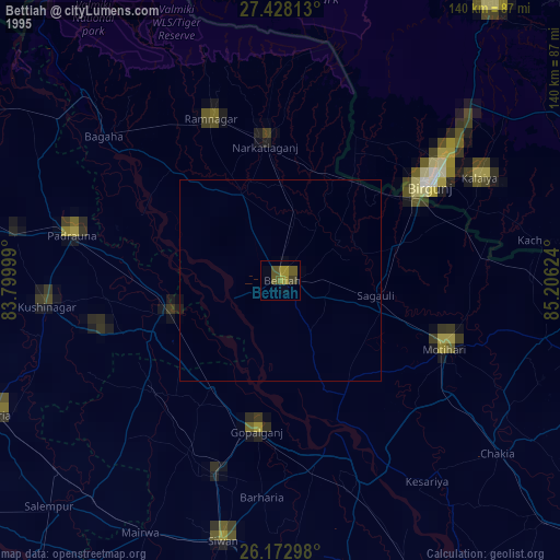
» NASA, Earths city lights 1995
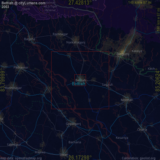
» NASA city lights 2003
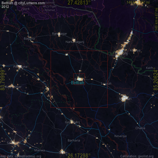
» Earth at Night: Flat Maps 2012, 2016