Birgañj night lights from space
Night Light of Birgañj (Province 2) from space (Nepal) Src. Average luminocity for 10x10km area is 61.9147% and for 50x50km: 7.8237%.
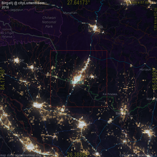
Analysis of Birgañj night lights 2016
Square area 10x10 km:
 15.28%
90-99
17.06%80-89
7.14%70-79
2.78%60-69
3.57%50-59
9.33%40-49
13.49%30-39
12.9%20-29
14.88%10-19
3.57%0-9
0%Square area 50x50 km:
0.93%90-99
1.24%80-89
0.56%70-79
0.5%60-69
0.58%50-59
1.1%40-49
1.44%30-39
2.02%20-29
3.2%10-19
6.47%0-9
81.97%Clear (daylight) street map image can be seen on geolist.org.
Map coordinates:
27° 38' 30.2" North, 84° 10' 39.6" East
27° 1' 1.5" North, 84° 52' 50.9" East
26° 23' 20.3" North, 85° 35' 2.1" East
Some cities around Birgañj sort by population:
• Bettiah, IN
44.4 km =27.6 mi,  237°
237°
• Mothīhāri, IN
41.1 km =25.5 mi,  175°
175°
• Hetauda
48.1 km =29.9 mi,  18°
18°
• Raxaul, IN
5.1 km =3.2 mi,  215°
215°
• Bairāgnia, IN
49.6 km =30.8 mi,  128°
128°
• Dhāka, IN
47.5 km =29.5 mi,  143°
143°
• Sagauli, IN
31.3 km =19.4 mi,  205°
205°
• Gaur
48.4 km =30.1 mi, 125°
1283581 (p: 133,238)
Sources (retrieved 2019-11-25):
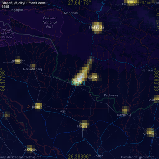
» NASA, Earths city lights 1995
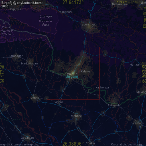
» NASA city lights 2003
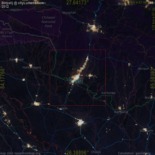
» Earth at Night: Flat Maps 2012, 2016