Najafgarh night lights from space
Night Light of Najafgarh (Delhi) from space (India) Src. Average luminocity for 10x10km area is 89.8902% and for 50x50km: 65.0612%.
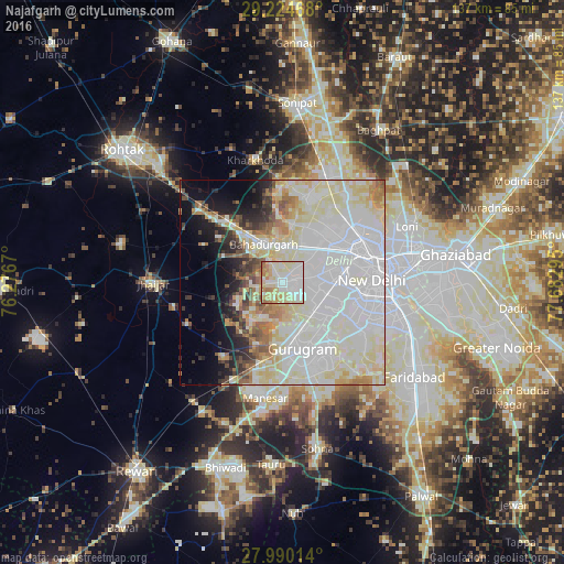
Analysis of Najafgarh night lights 2016
Square area 10x10 km:
 32.01%
90-99
23.86%80-89
29.36%70-79
5.11%60-69
7.95%50-59
1.7%40-49
0%30-39
0%20-29
0%10-19
0%0-9
0%Square area 50x50 km:
26.99%90-99
17.06%80-89
12.12%70-79
3.26%60-69
3.88%50-59
3.53%40-49
2.88%30-39
2.77%20-29
3.44%10-19
6.56%0-9
17.52%Clear (daylight) street map image can be seen on geolist.org.
Map coordinates:
29° 13' 28.8" North, 76° 16' 36.1" East
28° 36' 33.2" North, 76° 58' 47.4" East
27° 59' 24.5" North, 77° 40' 58.6" East
Some cities around Najafgarh sort by population:
• Rohini
17.2 km =10.7 mi,  29°
29°
• Karol Bāgh
21.1 km =13.1 mi,  77°
77°
• New Delhi
24.1 km =15 mi, 82°
• Gurgaon
17.2 km =10.7 mi,  164°
164°
• Nāngloi Jāt
11.6 km =7.2 mi,  47°
47°
• Bahādurgarh
10.3 km =6.4 mi,  335°
335°
• Bawāna
21.7 km =13.5 mi,  14°
14°
• Farrukhnagar
23.6 km =14.7 mi,  220°
220°
1262111 (p: 1,365,000)
Sources (retrieved 2019-11-25):
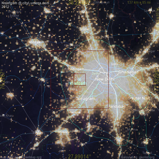
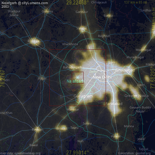
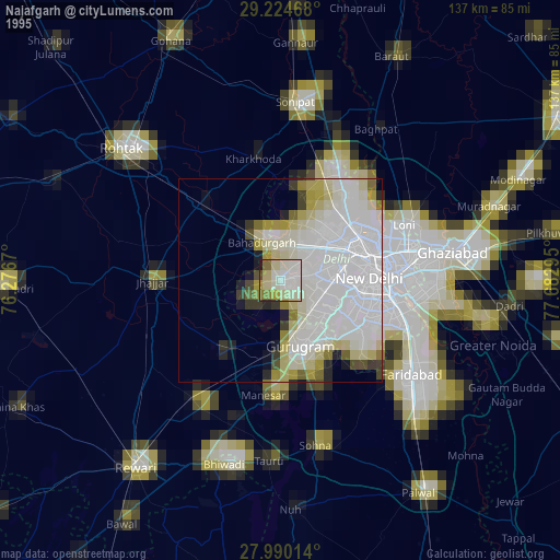
» NASA, Earths city lights 1995
» NASA city lights 2003
» Earth at Night: Flat Maps 2012, 2016