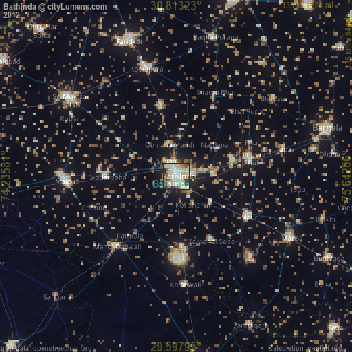
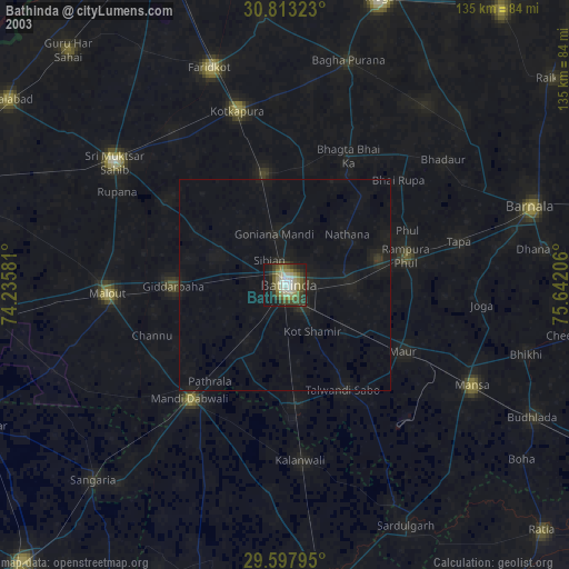
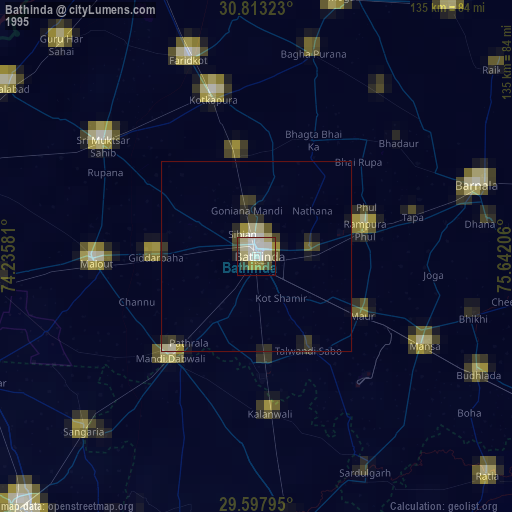
Bathinda night lights from space
Night Light of Bathinda (Punjab) from space (India) Src. Average luminocity for 10x10km area is 78.3147% and for 50x50km: 17.65%.
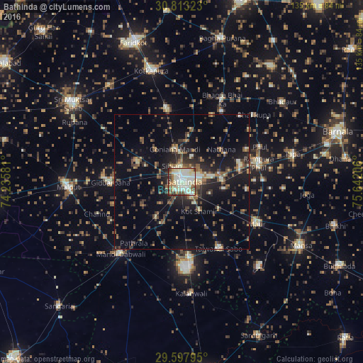
Analysis of Bathinda night lights 2016
Square area 10x10 km:
 13.81%
90-99
34.79%80-89
13.99%70-79
5.42%60-69
7.34%50-59
8.92%40-49
5.77%30-39
6.47%20-29
3.5%10-19
0%0-9
0%Square area 50x50 km:
0.81%90-99
2.73%80-89
1.58%70-79
1.45%60-69
2.29%50-59
3.55%40-49
3.48%30-39
3.67%20-29
5.85%10-19
11.9%0-9
62.68%Clear (daylight) street map image can be seen on geolist.org.
Map coordinates:
30° 48' 47.6" North, 74° 14' 8.9" East
30° 12' 26.9" North, 74° 56' 20.1" East
29° 35' 52.6" North, 75° 38' 31.4" East
Some cities around Bathinda sort by population:
• Kotkapura
42.9 km =26.7 mi,  346°
346°
• Malaut
43.9 km =27.3 mi,  270°
270°
• Dabwāli
34.6 km =21.5 mi,  213°
213°
• Rāmpura
29.5 km =18.3 mi,  79°
79°
• Giddarbāha
26.2 km =16.3 mi, 268°
• Jaito
27.5 km =17.1 mi, 350°
• Maur
32.9 km =20.4 mi,  114°
114°
• Kālānwāli
41.5 km =25.8 mi,  175°
175°
1276070 (p: 242,800)
Sources (retrieved 2019-11-25):
» NASA, Earths city lights 1995
» NASA city lights 2003
» Earth at Night: Flat Maps 2012, 2016