Kālānwāli night lights from space
Night Light of Kālānwāli (Haryana) from space (India) Src. Average luminocity for 10x10km area is 11.496% and for 50x50km: 6.0414%.
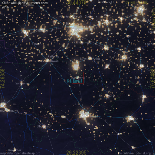
Analysis of Kālānwāli night lights 2016
Square area 10x10 km:
 0%
0%90-99
0.79%80-89
1.59%70-79
0%60-69
1.19%50-59
3.17%40-49
1.59%30-39
1.59%20-29
3.77%10-19
16.87%0-9
69.44%Square area 50x50 km:
0.28%90-99
0.67%80-89
0.3%70-79
0.57%60-69
0.69%50-59
1.18%40-49
1.21%30-39
1.66%20-29
1.88%10-19
4.31%0-9
87.27%Clear (daylight) street map image can be seen on geolist.org.
Map coordinates:
30° 26' 37.6" North, 74° 16' 6.9" East
29° 50' 8.6" North, 74° 58' 18.1" East
29° 13' 26.2" North, 75° 40' 29.4" East
Some cities around Kālānwāli sort by population:
• Bathinda
41.5 km =25.8 mi,  355°
355°
• Sirsa
33.9 km =21.1 mi,  170°
170°
• Mānsa
44.8 km =27.8 mi,  67°
67°
• Dabwāli
25.8 km =16 mi,  299°
299°
• Sangariā
48.9 km =30.4 mi,  265°
265°
• Maur
38.4 km =23.9 mi,  44°
44°
• Rānia
37 km =23 mi,  200°
200°
• Sardulgarh
30.1 km =18.7 mi,  122°
122°
1268469 (p: 27,355)
Sources (retrieved 2019-11-25):
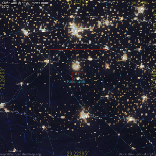
» Earth at Night: Flat Maps 2012, 2016